CloudStation, the new software by YellowScan

YellowScan, the UAV LiDAR Solutions leader, announced today the release of its new software.
CloudStation provides a complete solution to create and manipulate point-cloud data. It allows you to extract, process and display data immediately after flight acquisition. The auto-generation of flight lines and the production of LAS files are now done in a few clicks.
“This launch is an exciting move for YellowScan, it allows a better and simplified experience for the customers.” says Tristan Allouis, Chief Technical Officer of YellowScan. He adds “Better user experience leads to more efficiency for our demanding clients’ projects.”
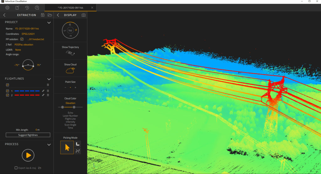
YellowScan Vx-20 Acquisition – Powerlines
Key business benefits that can be achieved from using CloudStation include:
- Checking the integrity of your data in the field
- Verifying your area coverage
- Making sure all objects you are mapping are identified
- Extracting your LAS files with only few clicks, within a few minutes
- Automatically suggesting flight lines
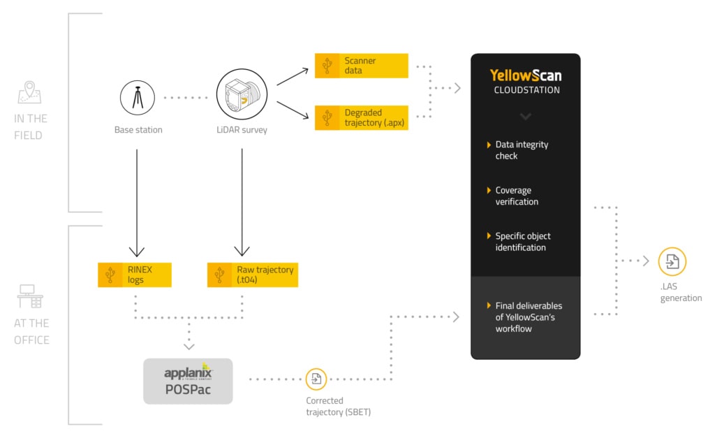
CloudStation workflow
CloudStation is immediately available with the acquisition of a YellowScan LiDAR solution.
If you want to learn more about the CloudStation’s workflow, request a personalized 1-on-1 demo via our Contact page

YellowScan Surveyor Acquisition – Chateau de Flaugergues, France
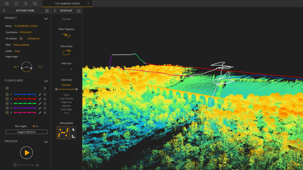
YellowScan Vx-15 Acquisition – Castries acqueduc, France