Found 144 Results
Page 2 of 2
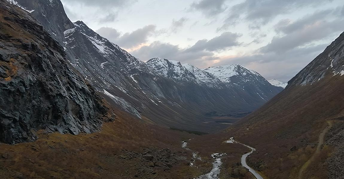
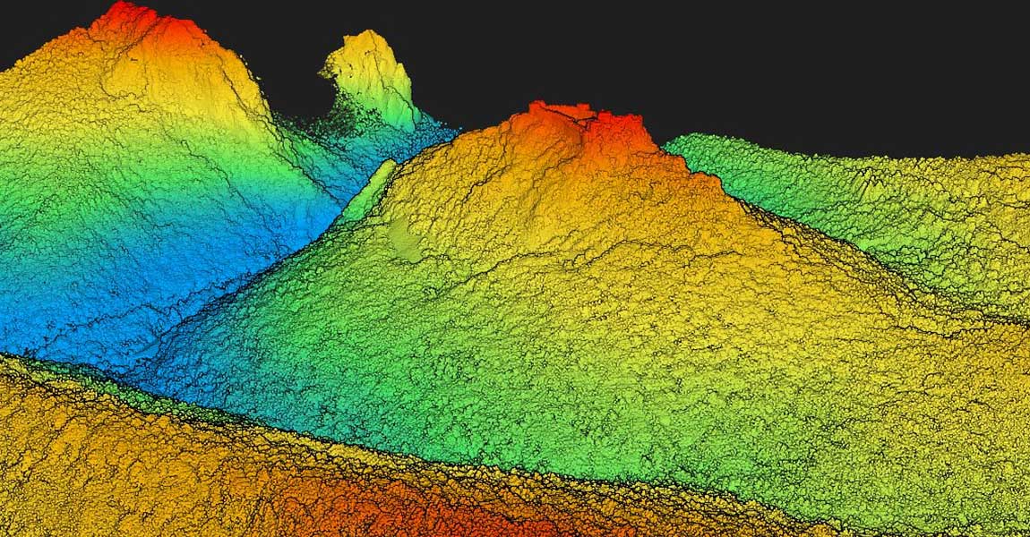
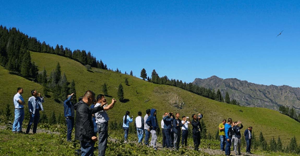
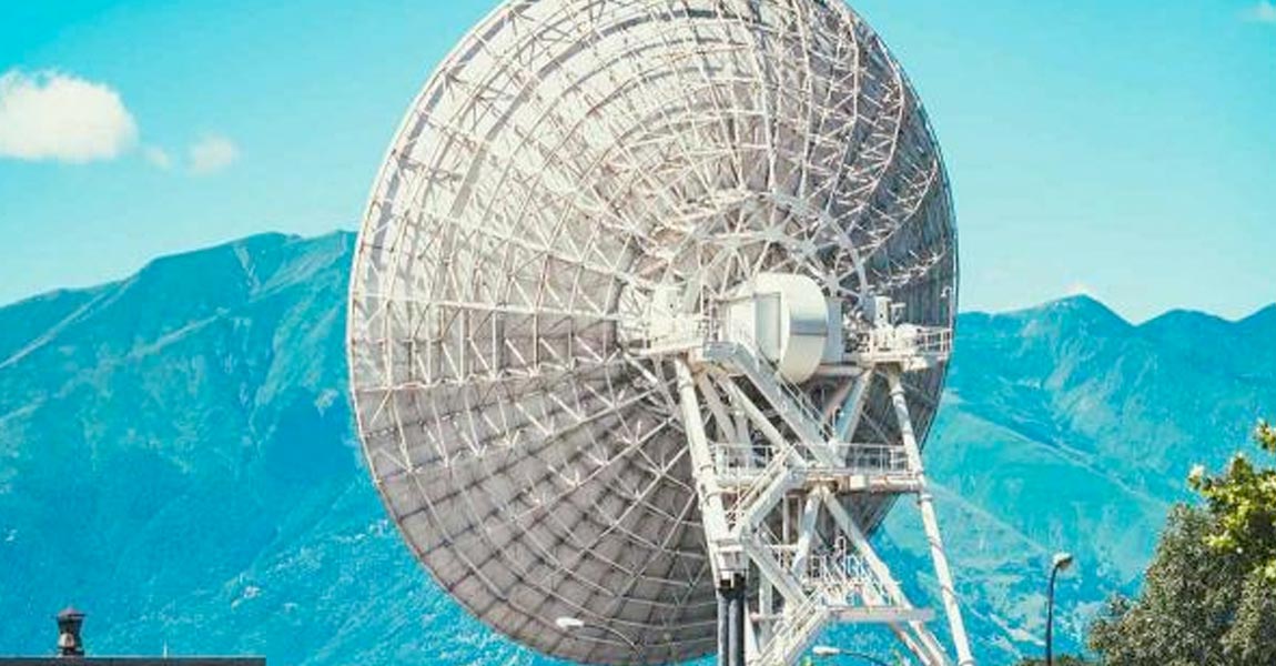
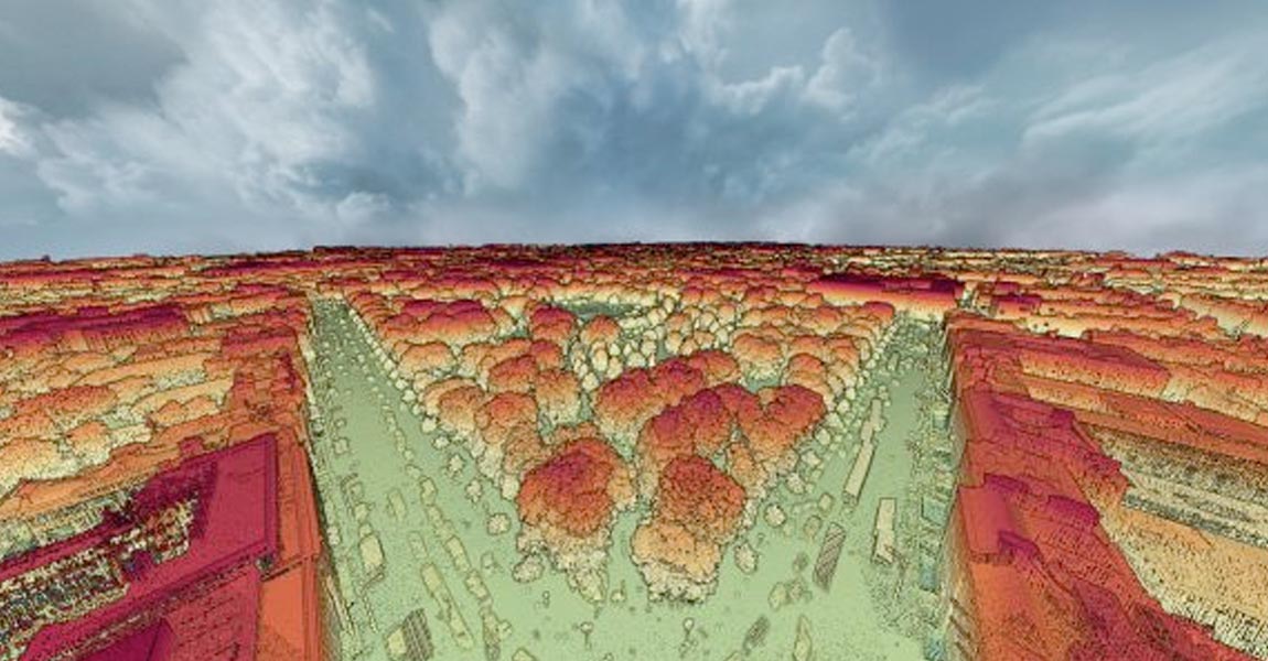
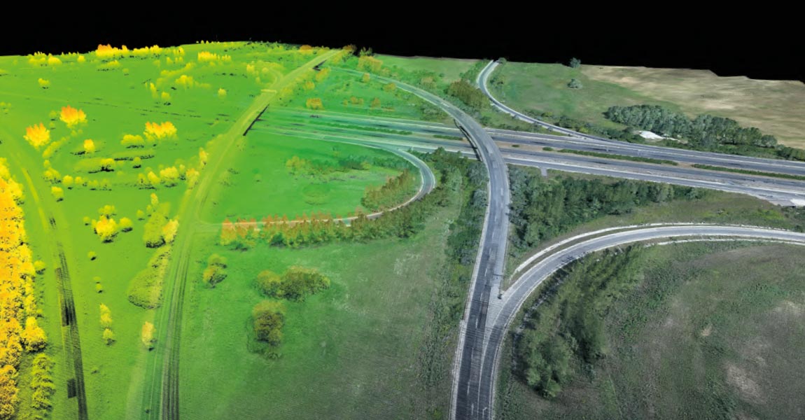
The Norwegian Public Roads administration Statens vegvesen and the Norwegian University of Science and Technology (NTNU) organized a proof-of-concept event in October of 2021 to bring together various government agencies to evaluate use of the latest LiDAR and drone technology to help with avalanche risk monitoring. They’d chosen the areas surrounding the iconic road called […]
29 March 2022
The Association Mission Patrimoine Mondial (AMPM) is an organization created to manage the process for the city of Carcassonne (South of France) and its Sentinel mountain castles better known as “Les Châteaux Cathares”, to successfully obtain UNESCO World Heritage certification. Built in the 13th century, the combined site is an exceptional example of military architecture […]
9 March 2022
YellowScan Global Support Community adds first Aussie Organization to Growing List Montpellier, France and Sydney, Australia – March 9th, 2022 – YellowScan, a global leader and designer of next generation manned and unmanned LiDAR solutions, announces the latest addition to its long list of YellowScan Global Partners Network, Sphere Drones. Founded in 2012 by Paris […]

What is the Challenge? Hepta Airborne, YellowScan’s Estonian based customer, won a contract with the Portuguese DSO (Distribution Service Operator) E-REDES, to launch a project with the objective of proving that drones can collect aerial inspection data just as well as manned helicopters missions. The plan was to compare data collected by drone to a […]
22 February 2022
Discover our new partner in Greece Montpellier, France and Maroussi, Greece – January 20th, 2022 – YellowScan, a global leader and designer of next generation of LiDAR solutions, announces an addition to its global distribution network, JGC. Established in 1999, JGC offers the Greek market the most technologically advanced Geoinformation Systems and satisfies the highest […]

11 February 2022
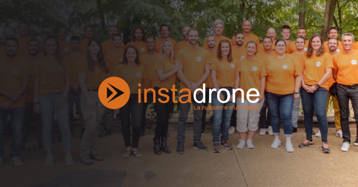
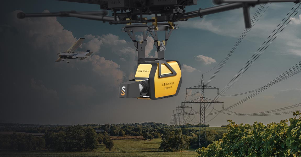
Explorer, the versatile LiDAR that can do it all YellowScan has signed a purchase agreement with Instradone. Instadrone will be the 1st customer in France to receive the YellowScan Explorer. Instadrone’s purchase is the latest endorserment for the Explorer and reaffirms the strong market of versatile LiDAR that can be mounted on a drone or […]
27 January 2022
YellowScan Global Support Community adds China to growing list countries covered Montpellier, France and Beijing, China January 13th, 2022 – YellowScan, a global leader and designer of next generation manned and unmanned LiDAR solutions, announces the latest addition to its long list of YellowScan Global Partners Network, EcoTech Ltd. Established in 2002, EcoTech is an […]
13 January 2022
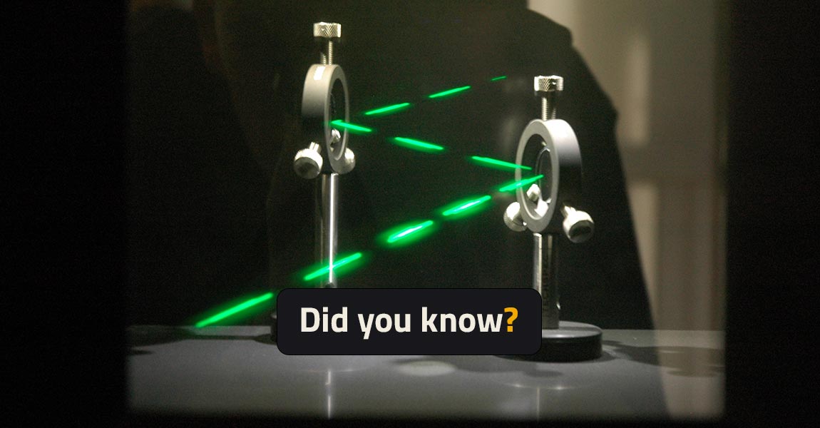
Did you know – Lasers classification For safety reasons, Lasers are classified depending on their potential risk of injuries to humans’ eye and skin. By law, all lasers products must have a label mentioning the class level. This number can be written either in Arabic numeral or in Roman numeral. In the case of European […]
13 December 2021
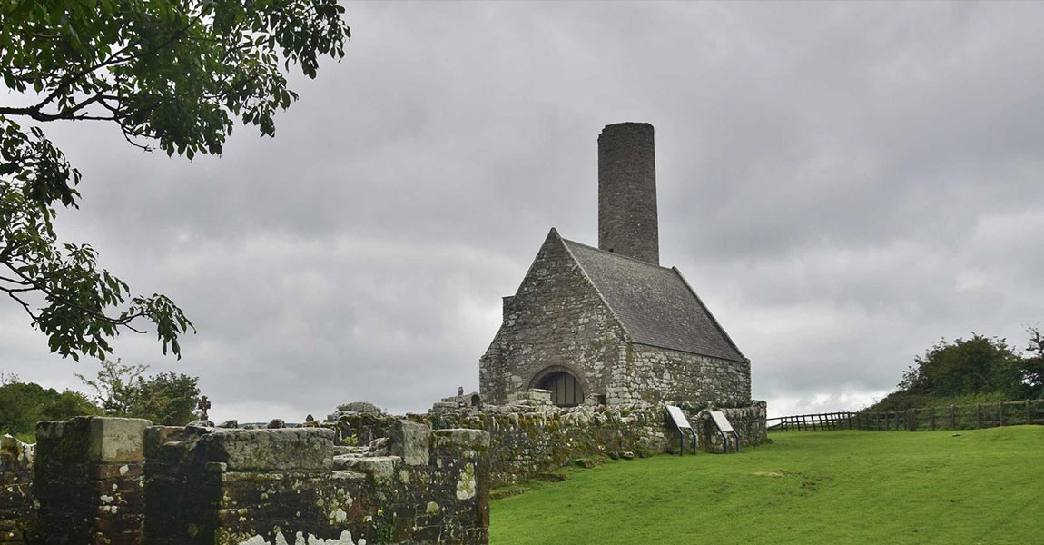
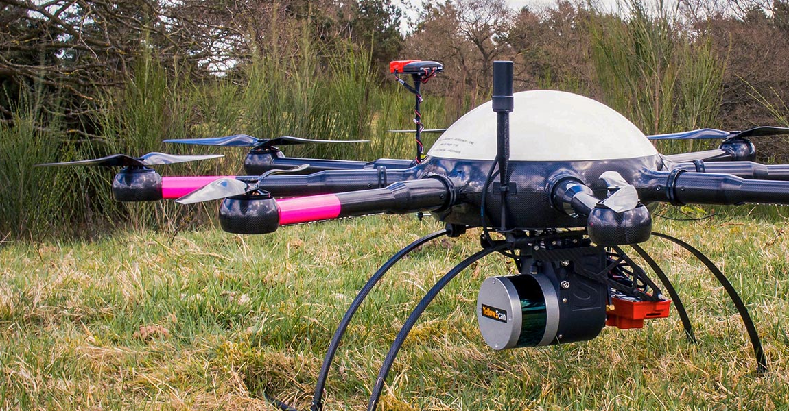
GeoAerospace, an Irish geospatial Data-as-a-Service provider, was contracted to provide high density LiDAR and high resolution orthophotography maps of Holy Island, a historic monastery on an island in Lough Derg, Ireland. The final data would become part of an archaeological assessment of the monastery. Digital Replica of Holy Island mission, © GeoAerospace 2021 What is […]
24 November 2021
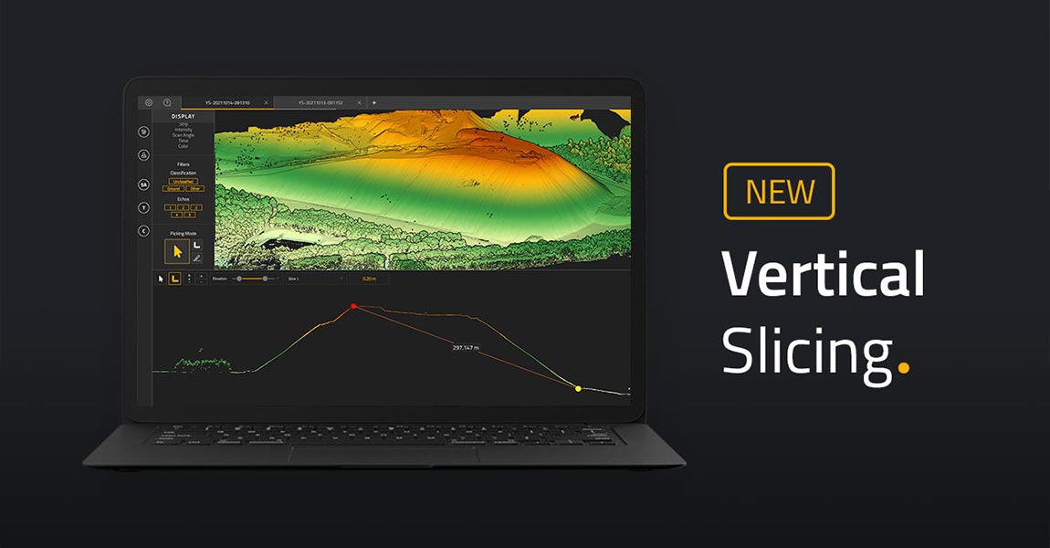
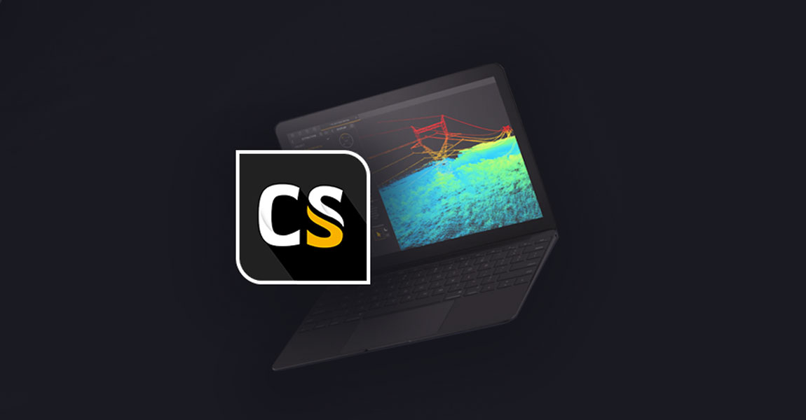
Latest feature in the YellowScan CloudStation helps users get a better understanding of generated point clouds. Check out this new feature in our CloudStation: Vertical Slicing! This new vertical slicing feature comes with CloudStation Core release 2110.0.0 as an additional tool. Vertical slices will help you get a better understanding of your generated point cloud. […]
10 November 2021
What is the challenge? The gypsy moth is an invasive species that can devastate forest canopies. In Vermont the gypsy moth is normally kept in check by a fungus, but abnormally dry conditions prevented the fungus from thriving resulting in an explosion of gypsy moth caterpillars. By June, the region was suffering the largest infestation […]
2 November 2021
The Intergeo 2021 Conference was held on September 21-23 in Hannover, Germany. https://youtu.be/DnhsuUv9q50 We were excited to be back in-person at Intergeo 2021 after nearly 2 years of not being able to attend a conference physically! Over 3 days we were busy chatting away at our booth with a steady flow of conference attendees stopping […]

4 October 2021
Commercial drone exhibitors and attendees gathered for Commercial UAV Expo Americas 2021, held September 7-9, 2021 at the Mirage in Las Vegas. Day 1 Today was a hot beginning to the UAV Expo event. Most of the day was taken up by live demonstrations at a testing site located outside Las Vegas (It was 43C […]

29 September 2021
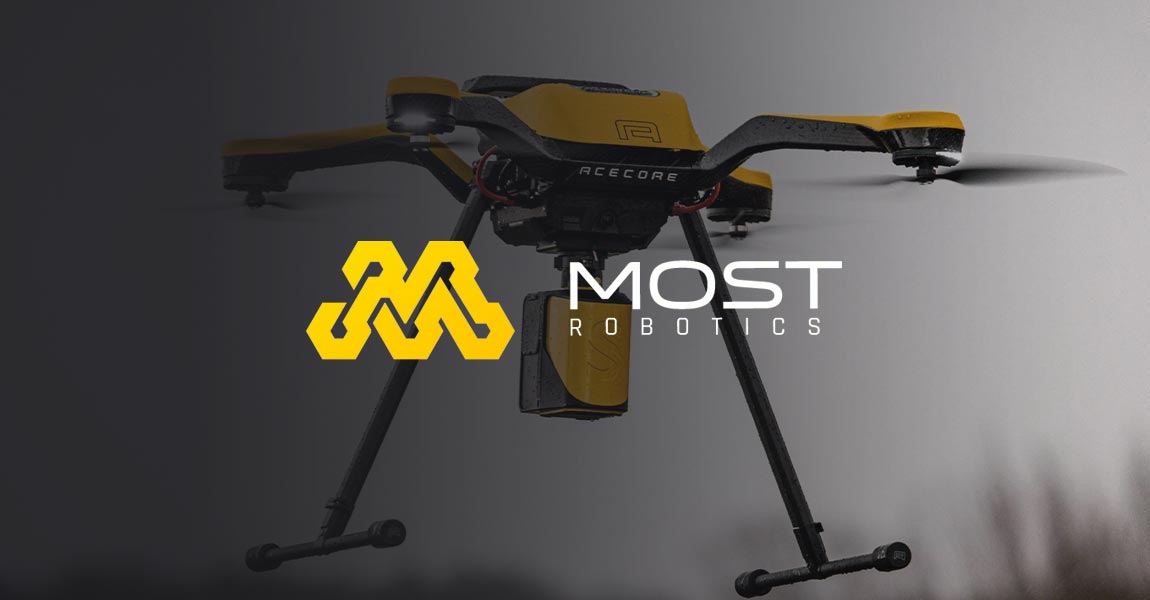
Newest member of YellowScan’s global community strengthens an already impressive European presence Montpellier, France and Duderstadt, Germany – September 29th, 2021 – YellowScan, a global leader and designer of next generation of UAV LiDAR solutions, announces an addition to its global distribution network, MOST Robotics. As an innovative German manufacturer of drone systems, MOST Robotics […]
Building on the recent launch of our Explorer high-end solution, Mapper+ brings more features and options to our successful mid-range solution offering. Montpellier, France – September 21st, 2021 – YellowScan, a global leader and designer of next generation of UAV LiDAR solutions, is proud to announce today the launch of newest LiDAR addition to our […]
21 September 2021
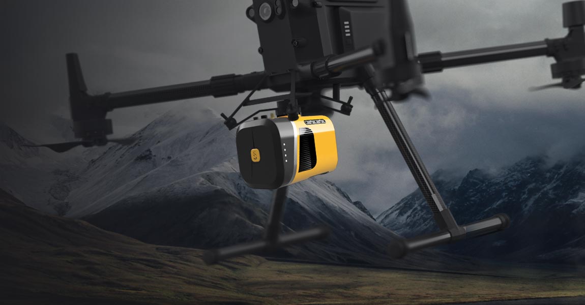
Our new flagship offering can be mounted on a light manned aircraft or switched to different types of UAV platforms Montpellier, France – September 7th, 2021 – YellowScan, a global leader and designer of next generation of UAV LiDAR solutions, is proud to announce the launch of our latest technological innovation, the YellowScan Explorer. The Explorer […]
8 September 2021
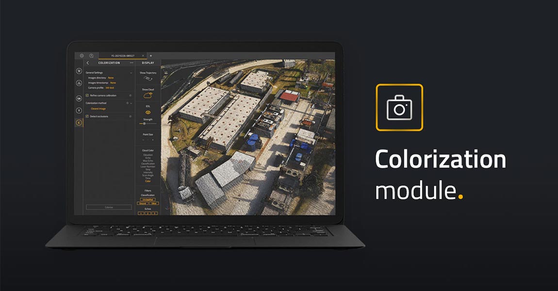
Latest add-on for the YellowScan CloudStation makes it easier than ever to colorize and visualize your data in a few clicks Montpellier, France – June 24rd, 2021 – YellowScan, a global leader and designer of UAV LIDAR solutions, announces the immediate availability of its new software add-on module: Colorization. This third software module enhances the […]
15 July 2021
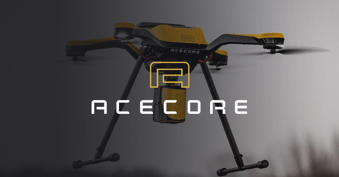
The YellowScan Mapper and Acecore Zoe combine to offer best-in-class highly accurate point cloud data and flight versatility in one package. Montpellier, France and Uden, Netherlands – June 2nd, 2021 – YellowScan, a global leader and designer of next generation of Unmanned Aerial Vehicles (UAV) LiDAR solutions, announces a new product collaboration with Acecore Technologies […]
2 June 2021
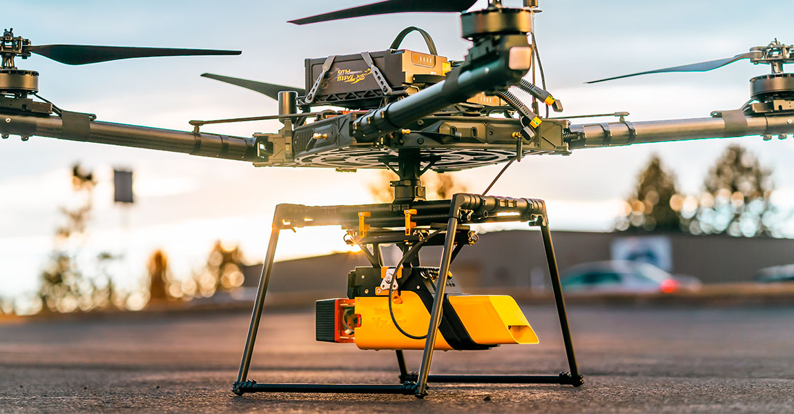
The Qube 240 payload is a geomatics grade LiDAR Scanner for the Trinity F90+ UAV and it is up to 60 min of flight time in this combination. It is offered as a complete solution, rounded up with YellowScan CloudStation Software pack, and license. Gilching, Germany, February 22nd, 2021 Light Ranging and Detection (LiDAR) sensors, […]
13 March 2021
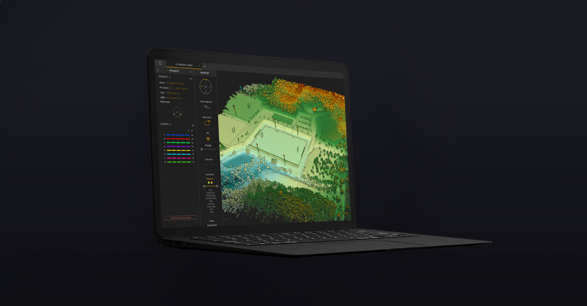
Add-on for the YellowScan CloudStation suite improves accuracy and ease of use for point cloud rendering YellowScan, a global leader and designer of next generation of UAV LIDAR solutions, announces the immediate availability of its new software add-on module: Terrain. This new module enhances the processing power of CloudStation, YellowScan’s powerful data processing tool […]
16 February 2021
Did you know? There are different scan patterns of LiDAR systems depending on the scanning method used. You may know how a LiDAR system works – measuring the travel time between the emission of a laser pulse and the reception of the signal that is reflected by a target. But have you ever wondered what […]
5 February 2021
Did you know? It is not recommended to use LiDAR in rainy or foggy weather. In contact with water, light deviates and so does the laser of a LiDAR system, thus impacting data quality. The main optical process occurring with fog is diffusion as for rain it is dispersion. In the first case, the light […]
26 January 2021
Did you know? There are three different ways to determine distances using LiDAR. LiDAR sensors are based on the use of one or multiple laser beams to perform distance measurements. They are active sensors, emitting radiation at a set wavelength and receiving the return signal. There are three main techniques for determining a distance measurement […]

24 November 2020
eVTOL and UAV LiDAR solutions used for a large-scale survey in Sumatra One of the biggest challenges of LiDAR surveys is productivity. In what follows, you will realize how efficient can be LiDAR mapping when you use and combine the right tools: UAV and LiDAR system. Indonesia has a big development program ending in 2024. […]
Why use DJI drones for LiDAR mapping? With the advancements in drone technology, what used to take weeks or even months to map can now be accomplished in a matter of days. DA Jiang Innovation, more known under DJI name is the number 1 drones manufacturer in the world. DJI drones are drones you must […]
1 October 2020
Interview: Hi Bjarke, thank you for accepting this interview! We know you have used YellowScan Surveyor for your biodiversity research work. Can you tell us a bit more about you and your research work? I am Bjarke Madsen from Aarhus University in Denmark. I have been a PHD Student for 3,5 years at Ecoinformatics and […]
28 September 2020
The differentiator for Diodrone is the high quality of the data they can collect thanks to YellowScan solutions. What is the challenge? Diodrone’s client is responsible for managing geotechnical risks along a 170km long rural road which travels through remote and rugged terrain in Australia that is prone to landslides. Diodrone conducts routine inspection and […]
21 September 2020
YellowScan has more than one way to reach centimeter-level accuracy. YellowScan LiDAR solutions use Applanix GNSS-aided INS boards allowing for multiple post-processing methods to reach centimeter-level accuracy. Using a dual-frequency GNSS receiver, like the one used in YellowScan LiDAR systems, can locate itself at a meter-level accuracy. However, most of today’s survey jobs require centimeter-level […]
25 August 2020
Another specificity of LiDAR wavelength: atmospheric absorption. A sun beam emits up to 150K lux. It is like receiving light from 15,000 candles at the same time. One that is direct or reflected, can be misinterpreted by the LiDAR and be considered as a laser return. The water molecules in the atmosphere absorb a good […]
21 July 2020
LiDAR wavelength is in the infrared range due to detector efficiency. Among all the existing wavelengths, why would one use infrared instead of other ones (UV, visible)? Most LiDARs wavelengths are in the infrared range as is the case for YellowScan systems: 903 or 905 nm. One of the objectives of the LiDAR system is […]
What should you consider for a successful UAV LiDAR integration? UAV LiDAR integration is key to start a mapping business for safety reasons but not only (productivity, quality of deliverables…). Here are 6 main things to consider: 1. UAV system endurance: 20+ minutes with a minimum 2kg payload is required. If not possible then you […]
7 July 2020
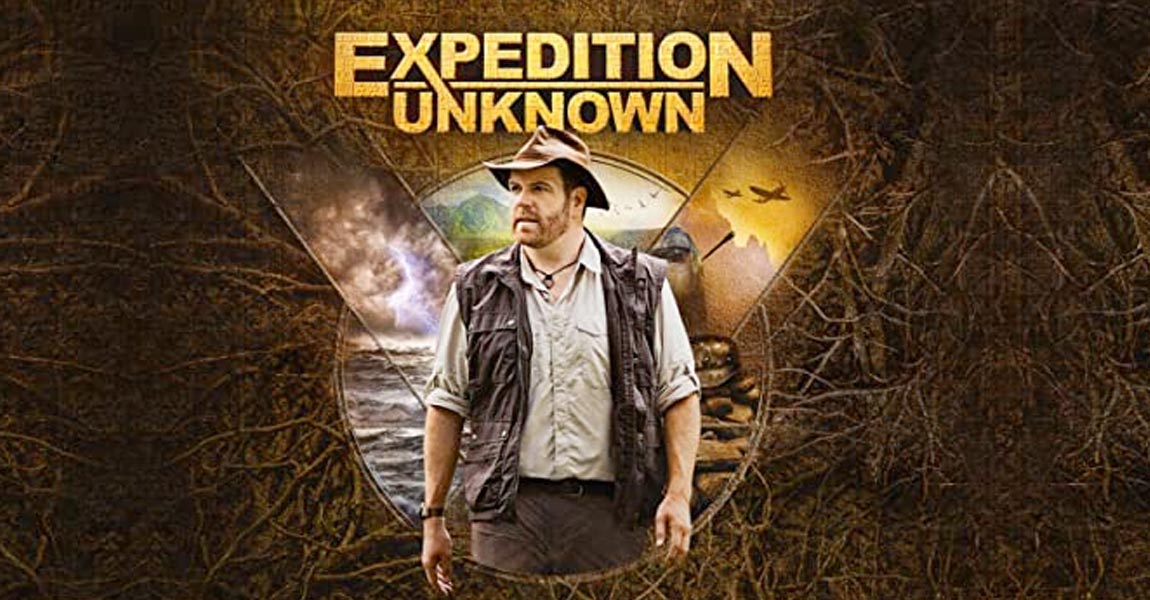
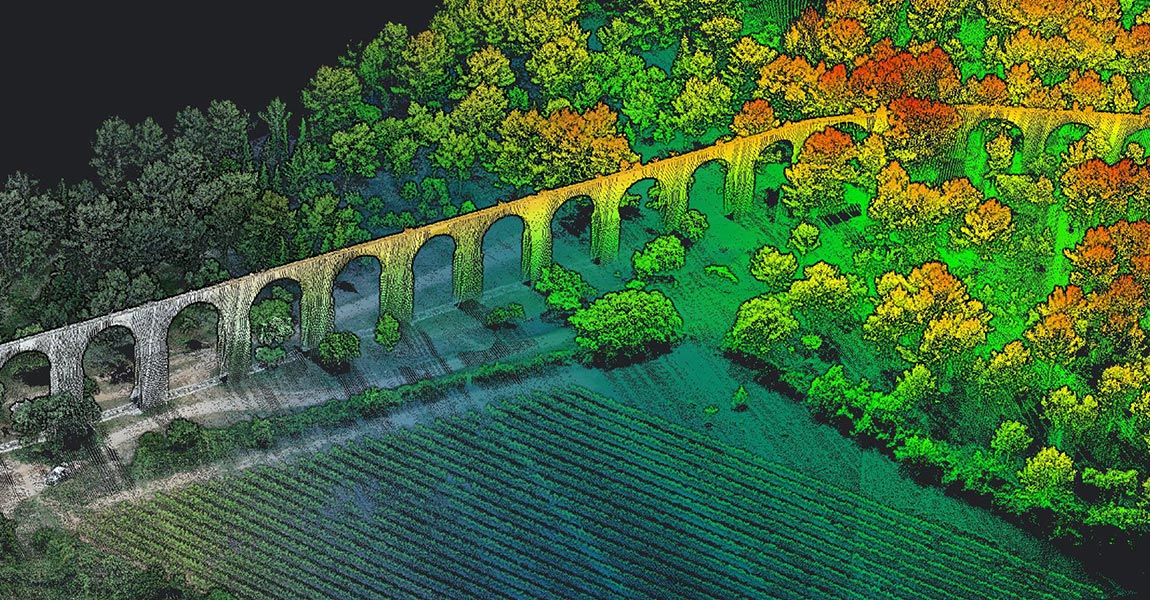
How UAS laser scanning helps archaeology On D-Day, Normandy was the theater of a massive firefight. 75 years later, we still have not found all buried structures from that period. In a field, not far away from Omaha beach, Josh Gates, presenter of the US TV show “Expedition Unknown”, is seeking new World War 2 […]
1 July 2020
The GPS position of LiDAR drones uses the General relativity, a theory of gravitation that was developed by Albert Einstein between 1907 and 1915. In order to understand this sentence, it is important to remember how a Global Positioning System (GPS) works. Satellites orbiting the Earth transmit information about their position and current time at […]

17 June 2020
Before LiDAR, mapping was done by combining the triangulation and levelling techniques. What is triangulation? Remember your math lessons! The sum of the angles of a triangle equals π radians (180 degrees), the law of sines and the law of cosines, Pythagoras’ theorem, trigonometry… does that mean anything to you? It’s due to these elements […]

29 May 2020
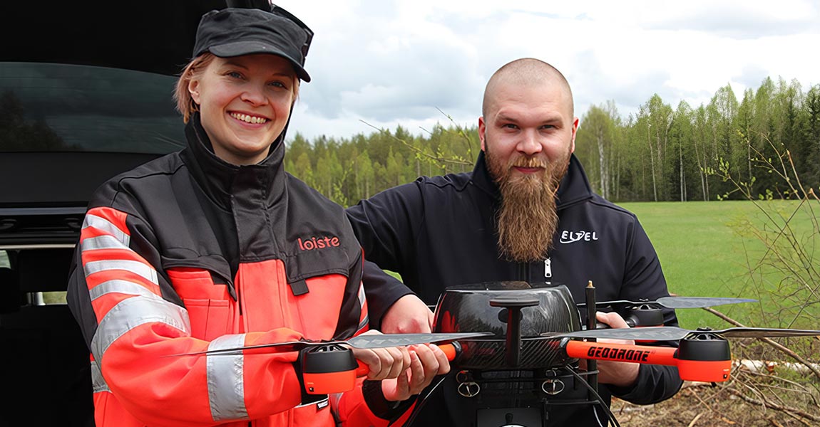
LiDAR for Drone mapping make Powerline network management easy Eltel, a Nordic field service provider for power and communication networks, conducted in 2019 a pilot study with Loiste a Finland-based energy company. The aim of the project was to investigate how drone LiDAR can be used for power grid design, maintenance and issue solving. Loiste, […]
28 May 2020
The difference between LiDAR (Light Detection And Ranging) and RADAR (Radio Detection And Ranging) is their wavelength. Although the basic purpose of LiDAR and RADAR is the same – detecting the presence and volume of distant objects – it is essential to understand the difference between these two technologies. Light Detection and Ranging (LiDAR) is […]
20 May 2020
3D point clouds triumph over theodolite method at thermal power station Until acquiring its YellowScan Vx-15 for 3D mapping, Ukraine’s EverScan used classic methodology (GNSS, Total Station, etc.) that took much longer to survey and hindered its engineers from achieving high accuracy. Moreover, the data they were acquiring was extremely redundant in terms of providing […]
14 May 2020
Flying LiDAR gives French company a competitive edge for Bali civil engineering and mining surveys Arnaud Denisot is a young IT engineer who decided to change his life. Four years ago, he left his job at La Défense, the Paris-region version of Silicon Valley, and re-established himself with a drone services company headquartered in the […]
13 May 2020
Mapping forested archaeological sites using UAV LiDAR: the example of the site “L’Escalère” in the South of France. Since 2016, the UMR 5608 TRACES Lab Research team uses YellowScan LiDAR (Mapper and then Mapper 2) to scan archaeological sites under forest cover. This time, the Toulouse-based research team flew their Mapper 2 on a DJI […]
7 May 2020
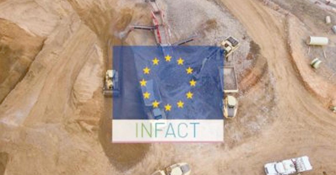
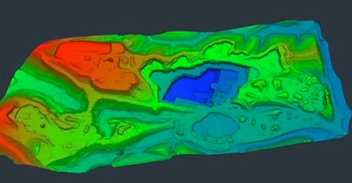
LiDAR mapping represents a key exploration tool for a future green mining industry Over the past two years, INFACT, an EU research initiative in the field of raw materials, has been busy working on the contribution of mineral exploration to transform Europe into a low-carbon and circular economy—that is, self-sustainable without incurring lasting damage to […]
29 April 2020
3D mapping with millions of point clouds makes mining project more viable Engineer Jim Smith, CAD technician Jerrad Burns and surveyor Charlie Patton at Sorrell-Smith Engineering Consultants LLC (2SEC) focus primarily on mining challenges where data acquisition, in particular mining surveys, require fast and accurate results. 2SEC is a full-service engineering design, planning and construction […]
20 February 2020
When it comes to capturing point clouds, it’s not a matter of LiDAR vs photogrammetry, because both have their benefits and drawbacks. It’s really about which method is most suitable for your particular application. YellowScan LiDAR point clouds help archaeologists map dense forest cover. LiDAR and photogrammetry can of course be applied as well to […]
18 February 2020
You know what they say: you’ve checked out the rest, now go for the best. After all, why compromise on quality when you want a safe investment and professional results? We’re fortunate that we live in a time when cumbersome airborne LiDAR operations are no longer the only way to get a survey done. Instead […]
5 February 2020
Nestled within the territory of the indigenous Kansa people, the area around Salina, Kansas happens to be one of the largest wheat-producing regions in the United States. Originally claimed by France as part of Louisiana, it was later acquired by the United States with the Louisiana Purchase in 1803. It’s not Salina’s history, however, that […]

27 January 2020
Drone-mounted and airborne LiDAR are changing the way architects, city planners and construction surveyors map the world’s major cities. Atteyeh Natanzi, PhD at and Iman Zolanvari PhD were post-doctoral researchers at University College Dublin’s School of Civil Engineering when they worked on a major urban LiDAR survey project. In a recently-published GIM International article, they […]
What is the best drone for your needs? One of the first decisions you’ll need to make when choosing a drone [or Unmanned Aerial Vehicle (UAV), also known as small Unmanned Aircraft Systems (sUAS)] for LiDAR mapping is the size and rotor/wing configuration. All the other choices to be made will be influenced by this […]
19 December 2019
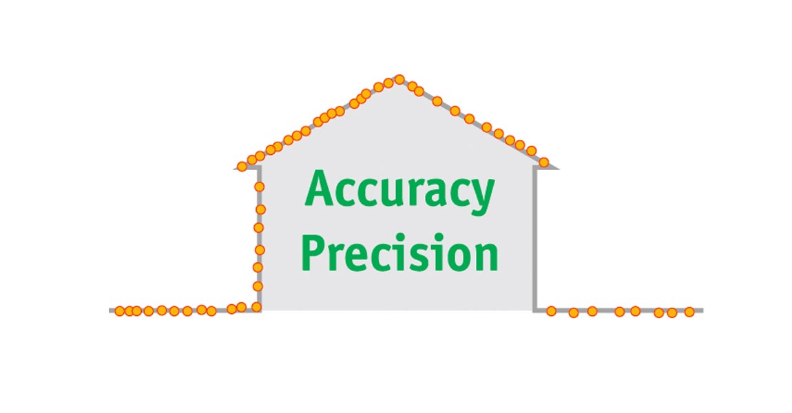
Why with LiDAR do we talk about precision and accuracy, what is the difference? Accuracy is the geographical precision, so it determines how far the point is offset. An accurate point cloud will be close in average to the actual position of the environment it describes. Precision is the repeatability of the measure. In LiDAR […]
16 December 2019
https://www.youtube.com/watch?v=XCHF36qNAaU This presentation explains the PP-RTX technology from Applanix, advantages and limitations in UAV LiDAR applications. To find out more, watch the video above. Discover our UAV LiDAR Solutions Find out more

19 August 2019
https://www.youtube.com/watch?v=tfQR8Im4P6Q YellowScan systems enables an increased knowledge of archeological sites by discovering new artifacts under vegetation. This presentation, in the form of a review of several prospecting archaeological sites, evokes topics such as the contribution of 3D modeling, complementarity with photogrammetry, interpretation of results and specific post-processing tracks. To find out more, watch the video […]
13 August 2019
https://www.youtube.com/watch?v=jI5fHi-bHp0 Ventus-Tech surveyed a 47 km-long highway segment in 2018 and produced survey results for the reconstruction of the highway with minimum interruption of the traffic. The project was conducted by Ventus-Tech using YellowScan Surveyor to collect data along a 47-kilometer segment of the M1 highway (E60, E65, E75) in northwestern Hungary. The data, gathered by 88 UAV flights […]
7 August 2019
https://www.youtube.com/watch?v=uqoDyT6atg8 Discover a powerful solution for corridor mapping and large surveys. Advantages of combining a vertical take-off and landing with high density LiDAR scanner. To find out more, watch the video above. Discover our UAV LiDAR Solutions Find out more
30 July 2019
https://www.youtube.com/watch?v=URjHbrYeGy0 Discover how UAV LiDAR can help to monitor biodiversity in wetlands. This project is about surveying a bog in harsh environments in an insular forest along the Loire river. A combination of LiDAR and multispectral imagery was applied over an area of 13 hectares, using a multirotor Fox-C8 OnyxStar drone coupled with YellowScan’s Surveyor […]
16 July 2019
A renewable energy company needed a LiDAR data acquisition to create access roads and pad sites for a wind farm development in Kansas. Brian Soliday from Juniper Unmanned, presents how YellowScan solutions are helping companies to save their client’s money and time. To find out more, watch the video above. Discover our UAV LiDAR Solutions […]
11 July 2019
YellowScan, the UAV LiDAR Solutions leader, announced today the release of its new software. CloudStation provides a complete solution to create and manipulate point-cloud data. It allows you to extract, process and display data immediately after flight acquisition. The auto-generation of flight lines and the production of LAS files are now done in a few […]
7 June 2019
Page 2 of 2


