Urban Tree Management with LiDAR

Challenge
Our customer PXL BIO-Research offers practice-oriented solutions in urban greenery management based on innovative research. In this context, they noticed an increasing demand from municipalities, urban planners and urban foresters for tools and expertise related to the digital inventory of urban green. Both updating tree inventories and assessing the condition of trees are time-consuming processes, often influenced by a certain level of subjectivity. An efficient and standardized method to collect information about the characteristics and quality of the urban tree community is a prerequisite for quick and targeted interventions.
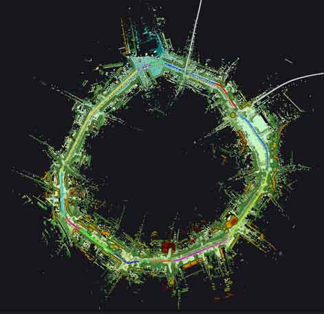
The mission aimed to update the tree inventory of the city of Hasselt in Belgium and to explore the potential of LiDAR technology to monitor the impact of management activities such as tree pruning in collaboration with local tree managers from De Beer & De Vos. To this end, relevant tree characteristics include the total number of trees, tree position, tree height, diameter at breast height, crown diameter, crown volume and branchless stem height.
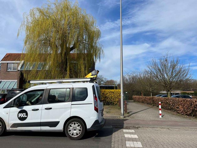
YellowScan Surveyor Ultra integrated in the Fly & Drive pod for mobile mapping
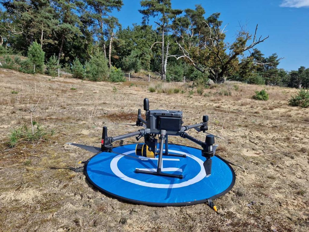
YellowScan Surveyor on a DJI M300 for airborne mapping
Solution
Besides an accurate and high-performing LiDAR-system, this project required a platform which is applicable in an urban setting. This environment is often difficult and inefficient to access with UAVs due to airspace and privacy restrictions. An approach based on mobile mapping is therefore more appropriate.
The YellowScan Surveyor Ultra v2 is a versatile, multi-platform LiDAR sensor which can be mounted on a car using the YellowScan Fly & Drive pod. By using it as a mobile mapping system, they combined high-resolution laser scanning with precise positioning to collect georeferenced point clouds which were used for individual tree detection.
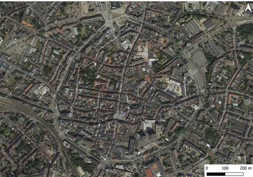
The town of Hasselt, Belgium from above
Pointcloud of Groene Boulevard in Hasselt, Belgium
Mission parameters
- Survey size: All street trees on the side of a 2.5 km road (527 trees)
- Duration: Planning 1 day, acquisition 2 times 0.5 day, processing 1 day
- Number of drives: 2 Drives
- Speed: 50 km/h
- Equipment: YellowScan Fly & Drive pod, YellowScan Surveyor Ultra V2 LiDAR system, YellowScan CloudStation, post-processing in R-software
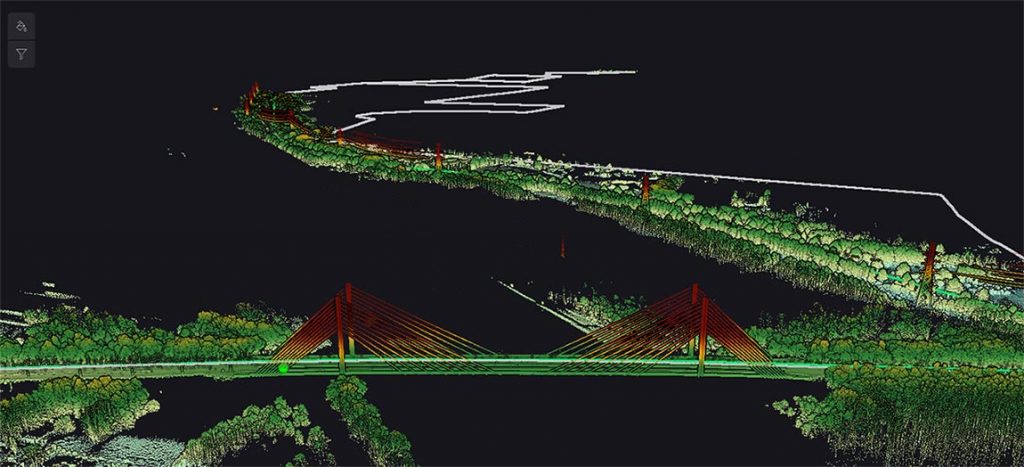
Pointcloud of a bridge
Results
Point density: 1610 points / m² (125,68 million points covering an area of 78076 m²).
The results showed it is possible to acquire detailed information about the relevant tree characteristics: not only about the position of each tree, but also about the tree height and even diameter at breast height, crown diameter, branchless stem height and crown volume. The accuracy of the outcome was validated based on 52 manually measured trees. In addition, by repeating the same drive mission after pruning a subset of the visited trees, we were able to quantify the differences in crown volume and thus the pruning intensity. This information will allow greenery managers in future to monitor the effects of management activities and link this with data about tree health.
One of the main deliverables was a vectorial dataset expressing the location of each tree and its characteristics. In addition, a detailed digital twin (3D point cloud) of each individual tree was generated and allows for a follow-up of the evolution in time (in relation with growth or management).
Manually visiting and measuring each tree would have taken about two days per session, totaling four days for pre- and post-pruning assessments. For characteristics like crown projection and volume, high accuracy is crucial to properly quantify the impact of management activities. Collecting this detailed data manually would have taken significantly longer.
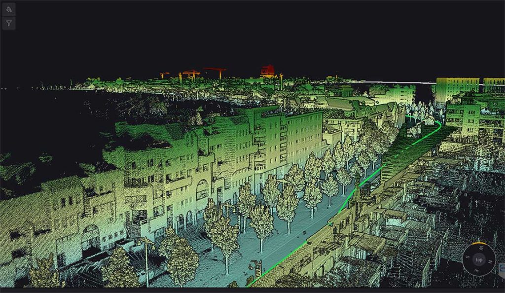
Pointcloud of Groene Boulevard in Hasselt, Belgium
We opted for the Surveyor Ultra system after an in-depth discussion with YellowScan. It soon became clear that this system in combination with the Fly&Drive option, was the best fit for our applications.
We benefited from the versability and complementarity of our Yellowscan Surveyor Ultra. We are able to drive when flying is too challenging and fly when driving is not feasible.