LiDAR vs Photogrammetry: Key Differences and Applications

This article compares two popular technologies for creating 3D models and maps: photogrammetry and LiDAR. The focus lies on key differences between both: how they work, the different outputs created for each, and popular use cases. The article finishes with a discussion of why investing in LiDAR can be a better choice, despite higher costs.
LiDAR and photogrammetry explained
LiDAR and photogrammetry are two popular technologies for creating 3D maps and models. Because both can produce similar outputs, they may seem identical on the surface, but the reality is that there are more differences than similarities.
This article explains what photogrammetry and LiDAR are, how they work and what are the key differences between the two.
A brief introduction
Both are remote sensing technologies. Remote sensing involves capturing information about an object or phenomenon without making physical contact with it. LiDAR uses 3D laser scanners that emit pulsed lasers to measure variable distances (ranges) that generate precise, three-dimensional information about the terrain and different surface types. LiDAR stands for Light Detection and Ranging and is also spelled as ‘lidar’ or ‘Lidar’.
Photogrammetry includes several techniques to capture, measure, and interpret photographic images to produce 3D models, maps, and other spatial data. These may include both aerial and terrestrial images, taken by different types of cameras on a variety of different platforms. Similar to how LiDAR is captured, these can be aerial platforms (drone, manned aircraft), as well as static or moving platforms on the ground.
The basic principles of LiDAR technology were developed in the 1960s, while photogrammetry has its roots in the mid-19th century. Photogrammetry advanced significantly during World War I and World War II, where it was used extensively for military mapping and planning. The advent of the computer allowed for more automated processing of images, boosting photogrammetry advancements.
Similarly, progressing laser technology and electronics in the 1970s and 1980s led to more practical and portable LiDAR systems. The 1990s saw further technological advancements in LiDAR including increased accuracy and resolution, combined with the emergence of commercial LiDAR systems and industry adoption. These and other developments laid the foundation for widespread use in the following decades.

Photogrammetry principle
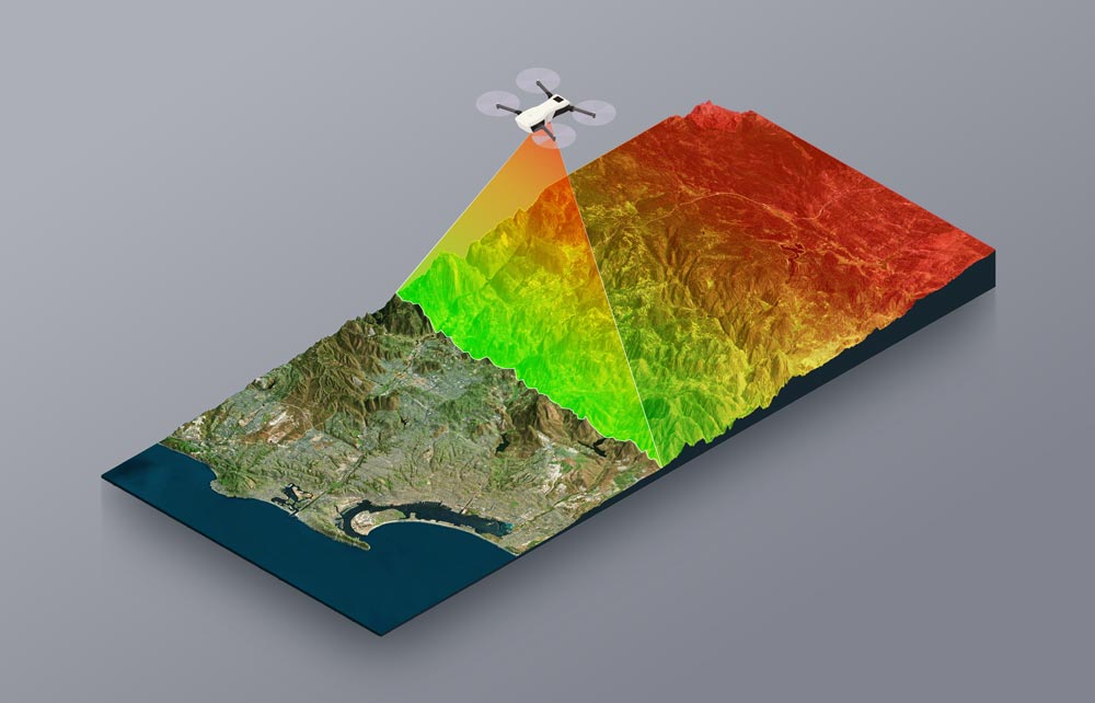
LiDAR principle
Main applications
Today, photogrammetry is widely used in fields such as cartography, architecture, and archeology, among others:
- Cartography and mapping: photogrammetry helps create detailed maps and GIS data by transforming photographic images into accurate and measurable 3D models and spatial data.
- Architecture and construction: photogrammetry enables the documentation and planning of building projects and inspecting structures with precise 3D models and maps.
- Archeology: photogrammetry helps to generate accurate 3D models of sites and artifacts without touching anything (hence the “remote” part of “remote sensing”). It captures fine details, supports virtual reconstructions, and facilitates monitoring of changes over time, enhancing archaeological and heritage studies.
LiDAR is used in areas such as forestry, agriculture, and environmental monitoring, among others:
- Forestry: LiDAR is capable of penetrating vegetation, allowing the measurement of tree height, canopy structure, and biomass, creating detailed 3D models. This allows for accurate forest inventory, monitoring changes, assessing health, and managing resources effectively to support conservation and sustainable forest management.
- Agriculture: LiDAR in agriculture provides detailed 3D models for precision farming, optimizing planting, monitoring growth, assessing yield potential, and improving overall farm efficiency and sustainability.
- Environmental monitoring: LiDAR creates highly detailed and accurate maps of terrain features. Maps with a high level of detail can help identify potential environmental risks, such as erosion, deforestation, and habitat destruction.
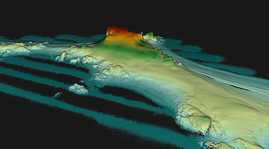
LiDAR pointcloud of an island in Antarctica generated in the YellowScan CloudStation
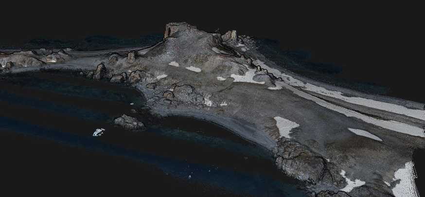
Colorized pointcloud of the same area. A camera module was used with the LiDAR system during the acquisition
Comparing LiDAR and photogrammetry
Now that we understand what LiDAR and photogrammetry are, as well as some of their use cases, we can compare them in more detail. We’ll explain that while LiDAR and photogrammetry are remote sensing technologies, they operate differently and have distinct characteristics. Next, we’ll look at some of the strengths and drawbacks of both LiDAR and photogrammetry.
Key Differences
Data collection, collected data attributes, cost, precision, and applications are some of the key differences between both technologies:
- Data collection: one key difference between LiDAR and photogrammetry is how data is collected. LiDAR uses laser pulses to measure distances and is an active remote sensing system. This means that the system itself generates energy (light). Photogrammetry uses passive sensing with photographic images. Passive sensors detect energy remitted or reflected from an object. While LiDAR can operate in the dark, photogrammetry relies on external ambient light and requires good lighting conditions. Photogrammetry generally cannot penetrate through dense vegetation, while LiDAR pulses can pass through gaps in the foliage and reach the ground like sunlight.
- Data attributes: LiDAR collects different information than photogrammetry. LiDAR typically captures x, y, and z coordinates, as well as intensity values. These are integer values that vary with the composition of the surface object reflecting the laser beam. Laser scanners produce 3D point clouds that contain all 3D point measurements. Photogrammetry captures 2D imagery, after which photogrammetry software uses a method called triangulation to produce 3D point measurements so that x, y, and z coordinates are known for each point. Photogrammetric imagery also contains color information in the form of RGB values (red, green, blue) to produce visually rich 3D models. LiDAR can integrate an RGB camera to also capture color information along with the 3D points, but this is not the default option.
- Deployment: Compared with photogrammetry, LiDAR is generally more expensive and requires expertise in data processing and analysis, however the deployment and processing time for LiDAR is significantly better than that of photogrammetry.
- Use cases: LiDAR and photogrammetry generally have different use cases, because of the unique characteristics and data captured by each. But there also may be instances where both are suitable for the job. In general, LiDAR is useful for applications that require a high precision and the ability to capture data through vegetation: similar to how light beams pass through small gaps in the canopy, LiDAR can see through dense foliage to map the ground beneath it. Photogrammetry is preferable for applications that require detailed and textured 3D models with realistic color representation.
It should be clear that the examples above are all generalizations, and that a preference for one technology or the other depends on many factors, including:
- Cost
- Time
- The size of the area that needs to be mapped
- The platform of choice
- The required output, among other factors.
It’s also important to mention that choosing one technology does not mean that the other cannot be used: both technologies can be combined so that the 3D model or derived output combines the individual strengths of LiDAR and photogrammetry.
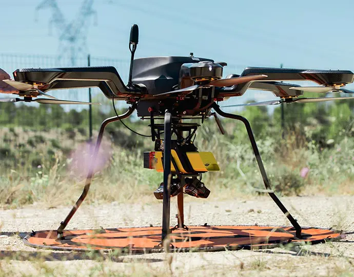
YellowScan Vx20 equipped with two cameras for colorization or photogrammetry purposes.
Possible limitations and drawbacks
In addition to the differences between the two technologies, these are some of the potential drawbacks and limitations of each one:
Possible LiDAR technology limitations and drawbacks:
- In addition to acquisition costs of LiDAR hardware and software, operational costs can be high, for example for hiring skilled personnel.
- LiDAR may struggle with surfaces that have poor reflectivity or are highly reflective. This results in incomplete data capture and may happen when capturing bathymetric LiDAR in highly reflective water bodies during certain hours of the day, or if the bed of the body of water is particularly dark.
- When capturing LiDAR data, objects may block the view of others, creating gaps or shadows in the data. These are called occlusions.
- Not all LiDAR systems integrate RGB cameras, so the color information may be limited. A possible solution to this problem is a colorized point cloud that combines RGB information from photogrammetry data.
Possible photogrammetry limitations and drawbacks:
- Photogrammetry relies on good lighting conditions to capture high-quality images. Weather conditions such as snow, rain, or fog, can hinder image capture and reduce data quality.
- Low-textured elements are also hard to capture and identify depth in, such as snow or sand.
- Similar to LiDAR, occlusions may occur during data capture, resulting in incomplete or inaccurate models.
- Photogrammetry accuracy depends on multiple factors: image quality, camera calibration, and processing algorithms. Errors may occur because of image misalignment, lens distortions, or insufficient image overlap.
- The achievable imagery resolution is limited by the camera’s resolution and distance from the captured object, which can be a limitation for large-scale projects or high-detail requirements.
LiDAR benefits over photogrammetry
By now, it should be clear that LiDAR and photogrammetry are two very different technologies. Both technologies have their benefits, limitations, and preferred use cases. One thing to notice when deciding to invest in LiDAR or photogrammetry is that although photogrammetry may be cheaper than LiDAR, the many benefits of LiDAR outweigh the lower price point of photogrammetry.
Here are some of the benefits of LiDAR over photogrammetry, despite the higher price:
- LiDAR directly measures distances to objects using laser pulses, providing highly accurate and precise 3D point clouds. In photogrammetry, distance measuring depends on multiple factors which potentially increases the chance of errors.
- Because LiDAR can penetrate vegetation canopies, it is particularly useful for applications like forestry, environmental monitoring, and archaeology.
- LiDAR can operate day and night, whereas photogrammetry relies on ambient light and is less effective in low-light conditions. It also generally works better under overcast or hazy conditions.
- LiDAR systems can quickly collect large amounts of data over extensive areas. LiDAR provides direct 3D spatial information, reducing the need for extensive post-processing and interpretation.
- LiDAR can provide absolute elevation data with high accuracy and performs well in areas with minimal texture or features, such as open fields or water bodies.
One example of a high-precision LiDAR system is the YellowScan Explorer, a compact LiDAR solution that can be mounted on light manned aircraft, helicopters or UAV platforms. It has the ability to detect and process up to five target echoes per laser pulse ensures optimal vegetation penetration. This system also has an embedded camera that can be used for colorization purposes.
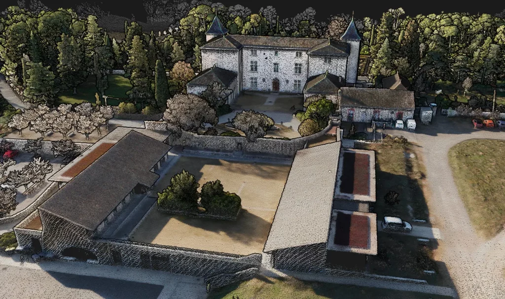
Colorized LiDAR pointcloud
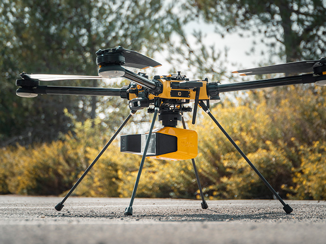
YellowScan Explorer mounted on a Hexadrone Tundra UAV
Frequently Asked Questions
Can you combine LiDAR and photogrammetry?
Yes. It is possible to capture LiDAR and photogrammetry data of the same area and merge the data, resulting in a single 3D model that contains accurate elevation and structural information from LiDAR, and photogrammetric data that adds high-resolution textures and color details.
What are the benefits of combining LiDAR and photogrammetry?
Combined LiDAR and photogrammetry offer the strength of each technology: LiDAR provides precise distance measurements, while photogrammetry adds detailed texture and color information.
What is a colorized point cloud?
A colorized point cloud is a 3D representation that combines the precise spatial data from LiDAR with the rich visual information from photogrammetric imagery. Each point in the point cloud is assigned a color value, that is derived from the photogrammetric imagery.