LiDAR remaps Diamond Vista Wind Farm in Tornado Alley

Nestled within the territory of the indigenous Kansa people, the area around Salina, Kansas happens to be one of the largest wheat-producing regions in the United States. Originally claimed by France as part of Louisiana, it was later acquired by the United States with the Louisiana Purchase in 1803.
It’s not Salina’s history, however, that makes it stand out, so much as the fact that one of the region’s defining characteristics is its frequent strong winds, making it ideal for the establishment of a wind farm.
(Talk about wind power…if the mere mention of Kansas reminds you of car-crushing tornados, we understand, for Salina also finds itself smack dab in the middle of the infamous Tornado Alley, America’s equivalent of the Bermuda Triangle—but that’s another story.)
Enter RES Americas, an Engineering Procurement Construction (EPC) contractor with a subcontract to create the Diamond Vista Wind Farm at an estimated cost of U.S. $400 million. Back in 2018, RES expected to set up 95 wind turbines, each with a rotor measuring 125 meters wide. The wind farm was expected to generate 1,300 gigawatts of wind power.
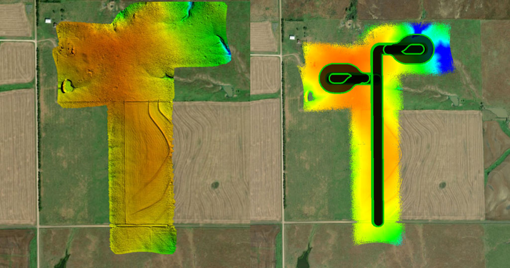
There was just one major glitch during the construction process, which proved to be the lack of highly accurate land surveys, a setback that caused expensive equipment delays. That’s where YellowScan’s Surveyor LiDAR came in to save the day. Operated by Golden, Colorado-based Juniper Unmanned, the drone-mounted Surveyor was able to remap over 8,800 hectares in just three days of collection, as opposed to traditional surveying methods that would have cost delays of up to six weeks. Because of the quality of the resulting digital terrain surface captured by the YellowScan Surveyor, RES saved an estimated one million dollars in additional earth-moving costs.

Bare earth Digital Terrain Model (DTM)
Burrowing into the details
Juniper Unmanned owns and operates one YellowScan Surveyor and three YellowScan Vx-20s. Brian Soliday, Chief Revenue Officer at Juniper, explains that with a traditional survey you might get a data point every 50 feet but with LiDAR “what we were able to do was deliver between 40 to 45 points per square meter–incredibly accurate data for [our client].” The quick turnaround time meant that the earthwork on the wind turbine pads was able to restart almost immediately.
In Soliday’s experience, most Juniper clients want photogrammetry’s high resolution orthophotomapping combined with LiDAR imagery that is derived from point clouds, a solution included in YellowScan equipment and software. “We use this approach for land developers where they’re going to go in and move dirt. We figure out where these objects are buried underground,” Soliday says.
The nitty gritty
The Diamond Vista Wind Farm wasn’t built overnight. First, RES and the prime contractor had to get approval from the town and the community, and then negotiate access contracts with some 200 landowners who controlled a total area of 19,000 hectares.
When construction on Diamond Vista began, there was a platoon of earthmovers at the ready that cost $5,000-7,000 dollars per day to have on site. But when they started cutting the pads and access roads, they quickly realized that the DTM (Digital Terrain Model) was significantly off. They were looking at a delay of four to six weeks if going with traditional survey methods. Juniper’s YellowScan LiDAR solution came to the rescue in 72 hours.
With the Surveyor, in three days they were able to collect data across 88 square kilometers. Pre-programmed flight missions captured 76-meter swaths of LiDAR. “On each one of these, we took the center line of the road, and we flew a defined offset on that, up and back each time, to make sure we had really good coverage,” Soliday says. “Some areas had heavy vegetation; others were clear. Although it was windy they were able to fly their drones with the Surveyor in winds up to 32 kilometers per hour. The sight logistics were tricky because these flights were [often] taking place in the middle of farmers’ fields. With the Surveyor, as long as they have a base station within three miles of that, they are able to collect data very accurately.”
Getting the data into the field
Once operators downloaded the YellowScan mapping data, Juniper managed to produce the results in just three days of processing. So, while it takes up to 42 days with a traditional survey, Juniper was able to put the data together in only nine days and change. In the end, RES required both DSMs and Digital Terrain Models in .xml format, along with 1-foot contours, cut-and-fill reports for each pad/road, and GPS machine control files.
“All they really wanted was GPS control files on a thumb drive that they could hand to a driver and it would control the blade on the earth movers,” Soliday says.

Machine Control Model
Welcoming the wind
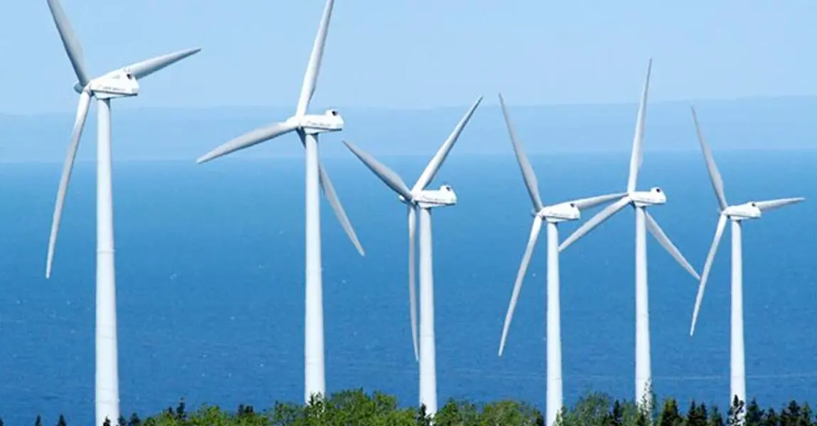
These days the Diamond Vista Wind Farm ranges over an area of 55,000 acres of land in Marion and Dickinson counties in Kansas. It is equipped with 95 Acciona Nordex 125-3.15MW wind turbines. Diamond Vista is expected to meet the electricity needs of 105,647 households, all while avoiding 900,000 tons of CO2 emissions a year.
Now here’s a happy ending: a portion of the Diamond Vista Wind Farm was acquired by global manufacturing company Kohler, supplying 100% of the annual electricity needed to power Kohler’s U.S. and Canadian operations and reducing its global greenhouse gas emissions by more than 25%.
NB: Author Jordan Robert


