INFACT deploys YellowScan Mapper II at Key European Mining Sites
LiDAR mapping represents a key exploration tool for a future green mining industry
Over the past two years, INFACT, an EU research initiative in the field of raw materials, has been busy working on the contribution of mineral exploration to transform Europe into a low-carbon and circular economy—that is, self-sustainable without incurring lasting damage to European environments. For INFACT researchers, LiDAR mapping represents a key exploration tool for a future green mining industry.
Richard Gloaguen heads up the Exploration technology department at the Helmholtz Institute for Resource Technology (part of HZDR Helmholtz-Zentrum Dresden-Rossendorf consortium) in Freiberg, and is INFACT’s scientific coordinator.
Gloaguen is INFACT’s scientific coordinator. He points out that INFACT seeks to support technologically efficient mineral exploration that engages in “innovative, non-invasive and fully acceptable exploration technologies.”
INFACT acknowledges that, “Despite a growing demand for mineral resources in Europe, and the importance of raw materials in the production of clean technologies, there remains a range of obstacles to raw material exploration. The INFACT project targets solutions across social, legislative and technical domains that will promote and facilitate sustainable mineral exploration via research on low-impact technologies, outreach to the general society and practical demonstrations.”
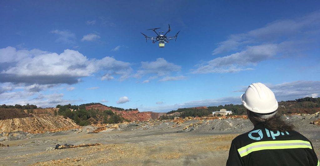
INFACT EU Research Project: Rio Tinto open-pit copper mining site, Spain
Says Gloaguen, “The project has pushed drone-based geophysics and hyperspectral imaging developments as well as new airborne geophysics techniques such as full tensor magnetic gradiometry and low-frequency electro-magnetics.”
INFACT has established three trial-run or reference sites in south, central and northern Europe—in Andalusia (Spain), Saxony (Germany) and Lapland (Finland) where technologies are “assessed and evaluated based on legal, environmental, sociological and technical performances.” The three reference sites have been set up in regions where mining already plays an essential role in the local economy, yet at the same time where people remain concerned about impacts on the ecosystem.
These sites cover a broad range of “geological, social and climatic conditions to ensure a rich variety of exploration challenges are catered to.” The site in Germany is the Geyer mine which excavates tin and tungsten; in Sakatti, Finland the government has granted an exploratory license to search for copper deposits, while Rio Tinto and Las Cruces are active copper mines in southern Spain.
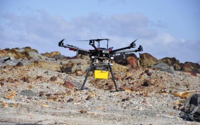
INFACT EU Research Project: YellowScan UAS LiDAR Mapper II
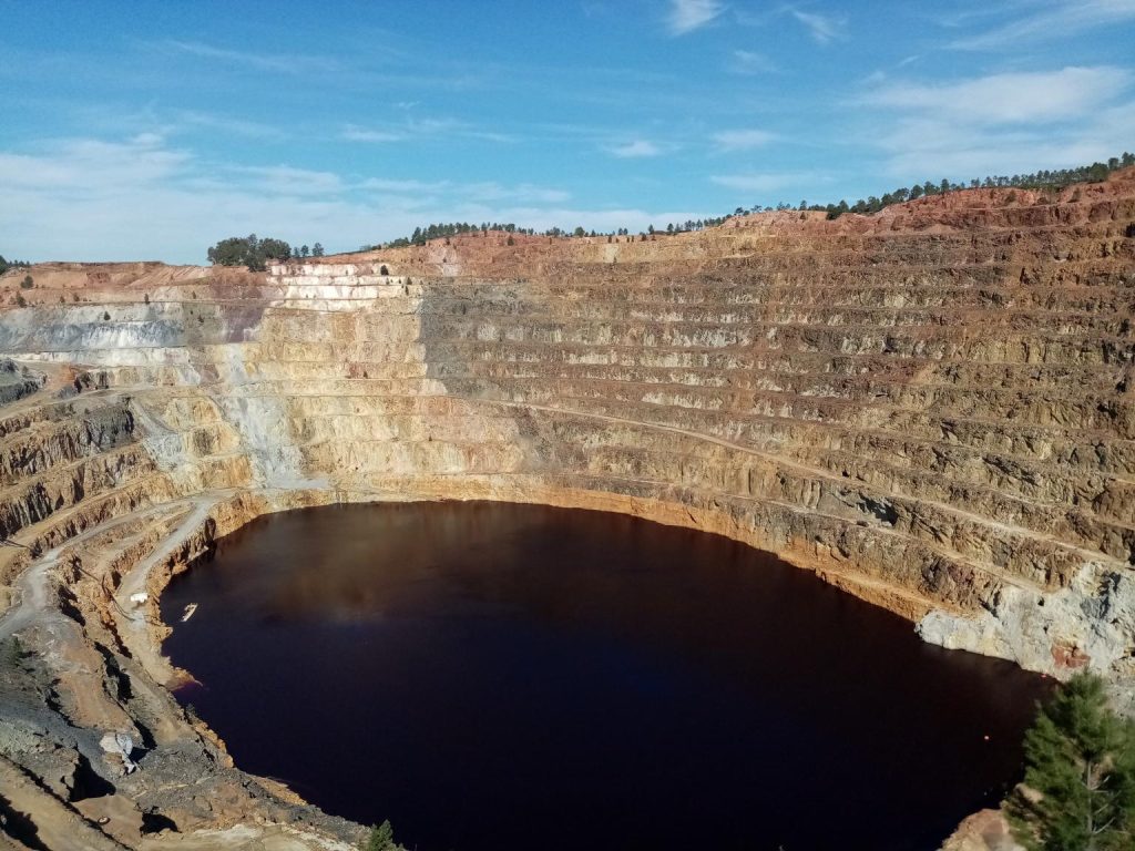
INFACT EU Research Project: Rio Tinto open-pit copper mining site, Spain
YellowScan’s Mapper II has been put into play to map relief, providing a 3D topographical view, and has been particularly successful in identifying areas under canopy or in between canopy, explains Robert Zimmermann, an engineer at the Helmholtz Institute. The use of LiDAR mapping also helps to improve and correct data from other sensors, including magnetics and photogrammetry.
Zimmermann says that the institute’s Mapper II has been deployed to gather research data for about two years at two of the reference sites (Germany, Spain), as well as in Namibia for Rare Earth exploration, and in Brazil for tailing characterization.
Ultimately INFACT urges exploration players to move toward a minimum environmental impact, applying technologies to reduce the industry’s footprint on the environment.
Rather than importing minerals from overseas, Europe can successfully explore its own natural resources in a more sustainable manner. “Even hybrid or electric cars,” Richard Gloaguen points out, “need cobalt, nickel and lithium in their batteries, and we use silver and tin in the circuitry of our mobile devices. What we say is that we should have responsible mining. In order to sustain electric mobility and the green deal we need to transition away from fossil fuels, but to increase efficiency, you will need materials such as copper, steel and so forth for a windfarm.”
Leila Ajjabou, INFACT’s project coordinator, explains further: “We argue that technological innovation in the minerals industry driven by the need to improve performance according to social, as well as environmental, safety and efficiency criteria could be an answer to a thriving exploration sector.”
Mining inexorably creates a lot of waste. Notes Gloaguen, “Two things come out of a mine—ore and waste. Although considered to be of no commercial value at the time they were extracted, waste stockpiles may still contain profitable material. This, combined with the fact that they are composed of blasted material readily exposed at the surface, make them an easy target for exploration and mining of secondary raw materials.”
From a survey viewpoint, says Zimmerman, “We use the Mapper II to have an idea of the volume of these stockpiles. We also use LiDAR and other tools to have a very good geometrical characterization. This can be used to calibrate other sensors, e.g., for the magnetics, we need extremely accurate topography.”
He adds, “The Yellowscan LiDAR is an invaluable tool to characterize the geometry of stockpiles all over the world. In combination with our other sensors it allows us to assess the potential value of raw materials waste and their latent associated hazards such as slope failures and acid mine drainage.”
In April 2019, the consortium performed a hyperspectral imaging and LiDAR survey for geological and topographic mapping of a waste rock dump of the Rio Tinto mine in southern Spain (pictured in the photos) which primarily mines iron and copper ore; the Mapper II was deployed as follows:
- Duration (planning, acquisition, processing): 1day planning, 1.5 days acquisition, 2 days processing
- Number of flights: 12 flights of 15min each
- Flight speed and altitude: 5m/s; 40m ATO
- Equipment: Yellowscan Mapper II on a DJI M600Pro; Trimble R10 as base station
Certainly, UAVs represent a unique opportunity to improve performance and increase the acceptance of exploration, one of the main goals of INFACT. The LiDAR data over the tailing from Rio Tinto had three applications: (1) it served as recent topography layer in the 3D volume calculation; (2) located and adjusted the starting points for drilling and (3) to georeference and topographically correct hyperspectral data collected over the same target.
Learn more about how YellowScan UAS LiDAR contributed to UAVs as a Tool for Socially Acceptable Exploration of Waste Rock Dumps EU INFACT research work.
NB: Author Jordan Robert
