Knowledge base
We know LiDAR technology, UAVs and light-crewed aircraft. We get involved in LiDAR research projects, conduct our own tests, have regular discussions with people that are interested in LiDAR.
We now want to share this knowledge with anyone interested in knowing more about how LiDAR works. We have therefore gathered our extensive knowledge about LiDAR mapping in one place to make it easier for you to learn more.
You can learn about upcoming technologies, read in-depth articles on different LIDAR-related topics, take part in research results or perhaps plunge into our comprehensive LiDAR mapping knowledge bank – the choice is yours!

For over three years, MOST Robotics, the YellowScan distributor for the DACH region, has collaborated with Clear Timber, a Dutch forestry inspection company, on various forest mapping projects.

Discover how advanced LiDAR mapping uncovers previously unknown Mayan ruins in Chichen Itza's protected zone.

Discover how LiDAR technology helped assess landslide risks in a large woodland prone to terrain instability and erosion.

Frontier Precision faced a critical challenge when their long-term client, the Alaska Department of Transportation (DOT), needed to rapidly and accurately map the area affected by the Mendenhall Glacier flood in Juneau, Alaska.

Scandinavian Drone’s challenge was to showcase the YellowScan Navigator's performance in the murky, dark waters typical of Scandinavia. To address these concerns, Scandinavian Drone needed to show that the Navigator could accurately capture underwater features and sediment deposits, even in challenging conditions.

Read how our customer used a YellowScan LiDAR system to transform urban tree management in Belgium, offering fast, accurate data collection compared to traditional methods.

This article explores how drones are transforming surveying by using LiDAR technology. Discover how drone-based LiDAR scanning captures precise 3D point cloud data from the air, understand the essential components of LiDAR system, and learn about its diverse applications in industries such as construction, mining, agriculture, and urban planning.

This article covers LiDAR in the context of capturing topography data. We’ll explain why LiDAR is a game-changer for capturing topography, and describe the different applications and industries benefitting from it. Finally, we’ll cover the different tools and methods to capture LiDAR topography and describe future trends.

This article covers 2D and 3D Lidar. We’ll compare both technologies and explain how they work, the different outputs of each, and their benefits, limitations, and popular use cases.

This article covers remote sensing and its applications. We’ll explain what is the difference between active and passive remote sensing, and cover the different technologies and platforms used for remote sensing. Finally, we’ll have a look at recent and future developments of remote sensing.

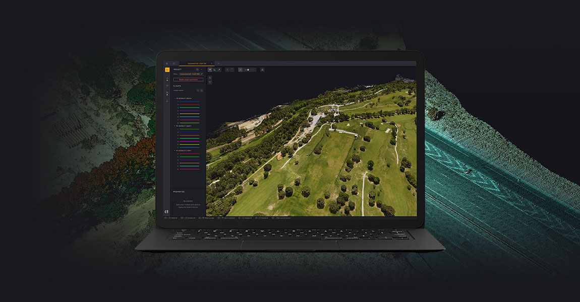
This article covers how LiDAR data is processed. We’ll cover the different steps required to turn raw point cloud data into useful information, and why these are important for end users. We’ll conclude with a brief overview of the functionality of CloudStation, which is YellowScan’s LiDAR data processing software.

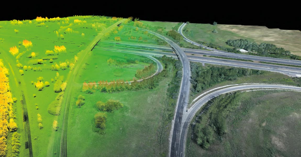
This article talks about mobile LiDAR scanning, a data acquisition method that uses a moving platform to collect precise 3D point cloud data. Learn how it works, the key system components, and its various applications in urban planning, infrastructure mapping, and more.

This article compares two popular technologies for creating 3D models and maps: photogrammetry and LiDAR. The focus lies on key differences between both: how they work, the different outputs created for each, and popular use cases. The article finishes with a discussion of why investing in LiDAR can be a better choice, despite higher costs.

The University of Vermont (UVM) in the USA became involved in this project through its connections with the Vermont Geological Survey (VGS) and the Vermont Agency of Transportation (VTrans). UVM is one of the few organizations in the state with access to UAS LiDAR technology, making it a priority contact for capturing accurate elevation data and models for landslides, especially when rapid data collection was required.

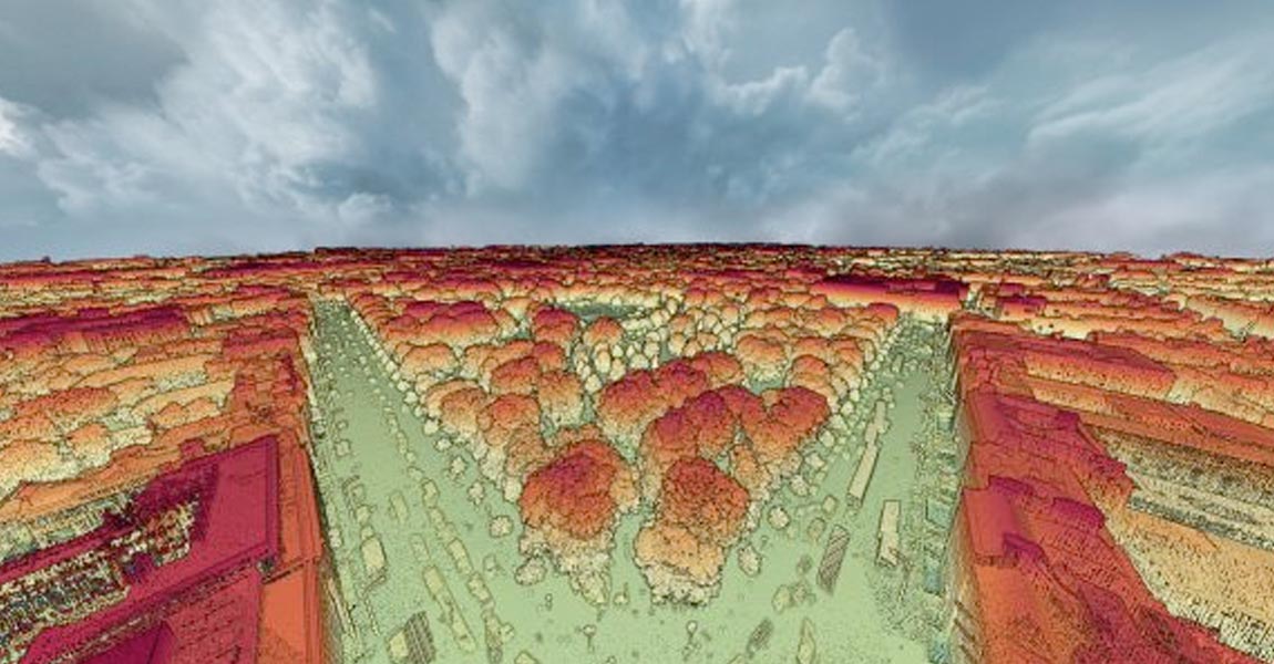
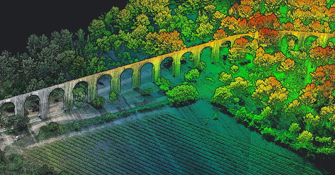
This article explains what LiDAR point clouds are and how they are used for 3D mapping applications. Learn the basics of LiDAR point clouds!

LiDAR scanners are used for capturing 3D point clouds. But how do they work? This and more are explained in the article below, which covers the operating principle of different LiDAR scanners and explains how distance measurements are transformed and combined into 3D point clouds. These provide the basis for many 3D mapping products used for different industry applications.

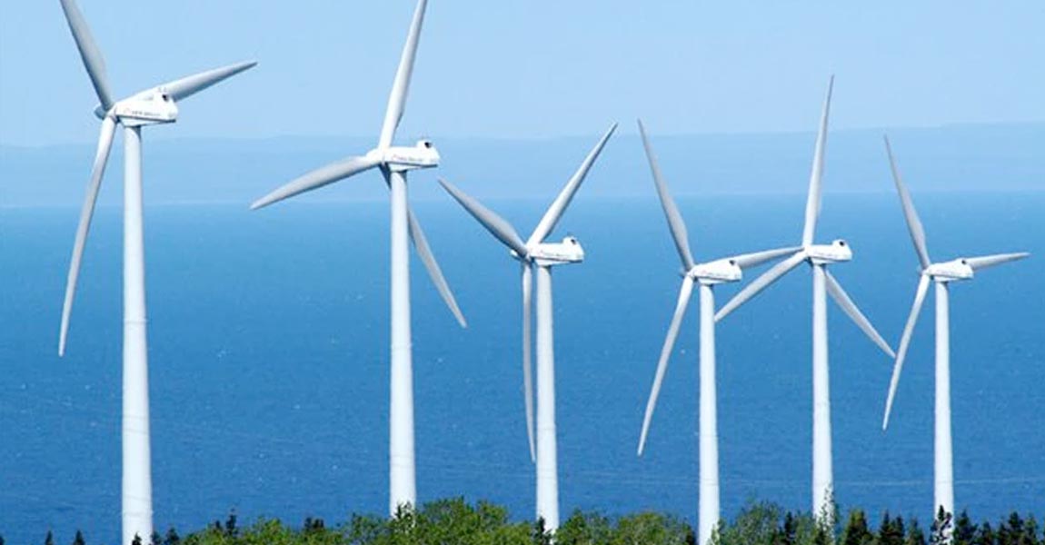
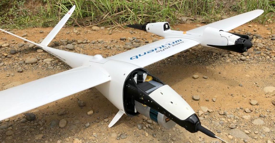
A LiDAR drone is an unmanned aerial vehicle (UAV) equipped with Light Detection and Ranging (LiDAR) sensors. A LiDAR is an active sensor that uses inertial measurement to correlate where it is on the earth’s surface, resulting in a direct measurement of the earth.

Carbonix, a leading manufacturer of commercial UAVs in Australia, became involved in a significant project when approached by an Australian power network seeking solutions for scanning their transmission and distribution lines in challenging, undulating terrain. They reached out to Carbonix to see if they had a system and sensor combination that could effectively meet their brief.

The project came about because an engineering company sought high quality topographical data to reassess how they were going to resume mine operations. This involved tasks such as creating new roads, avoiding collapse-prone areas, and creating protection meshes, etc.

European Hamsters are a protected species living in agricultural areas, often alongside field mice, which are considered pests. Lack of awareness about hamster presence leads to unintentional harm by farmers, endangering the European Hamster population.

In recent years, advancements in unmanned aerial vehicle (UAV) technology have enabled the collection of accurate and rapid data for various applications. One such application is ground topography determination, crucial for a range of fields such as agriculture, urban planning, and environmental monitoring.

In the realm of environmental monitoring and analysis, the accurate assessment of vegetation plays a crucial role in understanding ecosystems. Drones equipped with advanced imaging technologies have revolutionized this process by providing efficient and precise data collection methods.

How does laser scanning work underwater? How can a laser penetrate water? Discover this innovative technique for marine surveys and research.

Dive into the world of LiDAR drones: Explore UAV-mounted LiDAR sensors, their applications, and real-world benefits. Unveil aerial 3D mapping's potential now!

Discover how a customer created the digital twin of a telecommunications tower in order to perform line of sight and radio frequency simulation analysis.

Our client, CIMA+, a renowned multidisciplinary company based in Canada, specializes in engineering, project management, and consulting services across various sectors. They were commissioned to conduct surveys of electrical powerlines.

This mission was started by Instadrone in response to a request from the Departmental Directorate of Territories, which lacked LiDAR equipment and therefore outsourced the entire data capture process to drone companies.

Following a successful research and development collaboration with a government agency, our customer GeoAerospace obtained a contract to perform airborne LiDAR capture in various forestry sites along the secluded west coast of Ireland.

The number of megapixels is an easy number to put on a specification sheet, often shown on the first product page as a performance indicator. However, this is not the only value to consider as many other parameters are equally important depending on the use you will make of your camera for your LiDAR projects.

L'Avion Jaune, a company specialized in the production of earth observation data (multispectral imagery and LiDAR), tooks part in a study to model the hydrographic network and the hydraulic functioning of a wetland, within a nature reserve in New Aquitaine, France.

As part of a project directed by the archeologist Jean Soulat and the association “Archéologie de la Piraterie du XVII et XVIIIème siècle”, two excavation campaigns were organized to find traces of pirates...

Masarang Foundation, a 20-year-old ecological organization founded by world-renowned forester Dr. Willie Smits and based in North Sulawesi, Indonesia, has reforested 35 million trees to date.


L’Avion Jaune were mandated by the Departmental Council to conduct a risk assessment study of rockfall hazards on their road networks.

The SNCF wanted to compare UAV LiDAR surveys with those done with traditional methods, in a real work situation. Discover the success story.

The goal of this project was to generate a 3D model of the Huasco Pellet Plant (mining), in Chile, using the YellowScan Vx15 UAV LiDAR system.

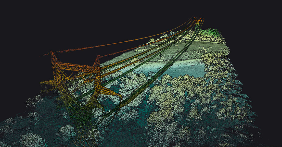
This LiDAR project, led by our customer Ventus-Tech, aimed to establish a baseline & record the status of the Chain Bridge in Budapest

Learn how the YellowScan Mapper LiDAR system was used in Antarctica to study the spatial distribution of penguins in their environment.

FlyThru was mandated by their client, the digital construction team at Eurovia Infrastructure, to survey an area for a roadway project.

Video games industry is turning to LiDAR technology to help it build 3D models in order to give players the best experience possible.

Discover how Drone Expertise Centre produced highly accurate topographic data of the Parc Astérix theme park in France.

Learn more about a proof-of-concept event to evaluate use of the latest LiDAR and drone technology to help with avalanche risk monitoring.

The Association Mission Patrimoine Mondial (AMPM) is an organization created to set up and drive the application strategy.

The stated objective was to produce LiDAR data that would ensure safety in the power line corridor by detecting dangerous vegetation.

Did You Know - For safety reasons, Lasers classification depends on their potential risk of injuries to humans’ eye and skin.

eoAerospace, an geospatial Data-as-a-Service provider, was contracted to provide high density LiDAR and orthophotography maps of Holy Island

Developing an understanding of changes to the forest structure caused by the gypsy moth outbreak with YellowScan’s Mapper LiDAR sensor.

Discover how different optical deflecting elements such as prisms, gratings and mirrors create specific scan patterns.

Understand how the light properties in contact with water can impact data quality of LiDAR systems, blocking part of the field of view.

Discover how triangulation, time-of-flight, and phase shift can determinate a distance measurement from a laser radiation.

Hutama Karya, a state-owned company building infrastructures, has been assigned to toll-road construction, on Sumatra island.

Discover the best DJI drones for LiDAR mapping and their strenghts. DJI M600, DJI M300, DJI M210/M200 are perfect for UAV LiDAR mapping needs.

Discover how Bjarke Madsen from Aarhus University in Denmark, used YellowScan Surveyor for its biodiversity research work.

Discover how YellowScan solutions helped Diodrone to collect high quality of data covering an area of 400ha of mountainous terrain.

3 different ways to reach centimeter-level accuracy for your LiDAR surveys, using the YellowScan LiDAR systems.

Another specificity of LiDAR wavelength: atmospheric absorption. Our LiDAR systems use special wavelengths: 903 nm and 905 nm. Why is that?

LiDAR wavelength is in the infrared range due to LiDAR detector efficiency. Why use infrared wavelength instead of other ones (UV, visible)?

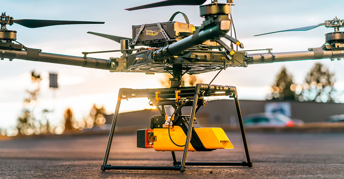
How to set up the perfect UAV LiDAR integration? Think about UAV endurance, LiDAR dimensions, mounting, vibrations, ground clearing distance.

UAS laser scanning technology fits archaeology needs. In Expedition Unkown TV show, YellowScan UAS laser scanning solution helps to find WW2.

Did you know? The GPS position of LiDAR drones uses the General relativity, a theory of gravitation that was developed by Albert Einstein.

Before LiDAR, mapping was done by combining the triangulation & levelling techniques. Let's go back to basics of mapping techniques.

Eltel, a Nordic field service provider for power and communication networks, conducted in 2019 a pilot study with Loiste a Finland-based energy company.

Did you know? The difference between LiDAR (Light Detection and Ranging) and RADAR (Radio Detection and Ranging) is their wavelength.

Discover how everScan speeds up stockpile volume calculation with LiDAR in a thermal power plant. Get precise volume calculation of stacks!

Discover how flying LiDAR gives French company a competitive edge for Bali civil engineering and mining surveys.

Discover how the UMR 5608 TRACES Lab Research team uses YellowScan LiDAR solutions to map micro-reliefs of archaeological interest.

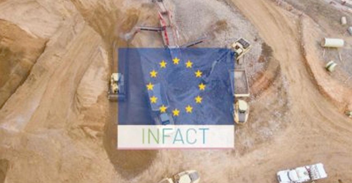
Major European INFACT mining project deploys YellowScan LiDAR for reliable 3D mapping, reducing the industry’s footprint on the environment.

Discover how 3D mapping with millions of point clouds makes mining project more viable saving $45,000 for surveying and data processing.

Combining LiDAR and Photogrammetry is the optimal way of gathering data. Discover the YellowScan dual solutions!

Intelligence, performance, experience, integration, technologies, support... Discover why YellowScan makes the difference !

Discover how Juniper reduced post-processing time to 3 days using YellwScan solution while it takes up to 42 days with a traditional survey.

Drone-mounted and airborne LiDAR are changing the way architects, city planners and construction surveyors map the world’s major cities.

Discover our guide to help you choose the best drone for your needs. Dive into our comparison of multirotor, fixed-wing or helicopter drones.

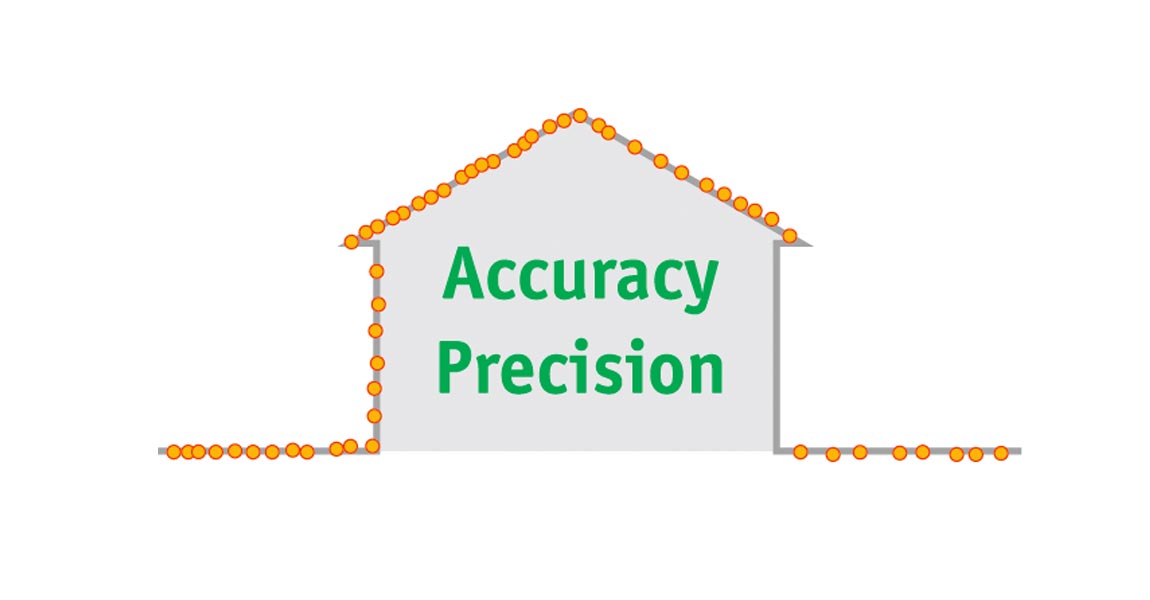
Accuracy is the geographical precision and it determines how far the point is offset but Precision is the repeatability of the measure.


Light Detection And Ranging (LiDAR) is a laser-based remote sensing technology. Discover the basic principles and how does LiDAR work.