YellowScan and Wispr announce strategic collaboration unveiling new integration at CUAV Expo 2024 in Las Vegas

August 23rd, 2024, Montpellier, France and Batesville, United States – YellowScan, a global leader in cutting-edge LiDAR technology, and WISPR, a pioneer in drone platforms and aerial intelligence, are excited to announce a new collaboration that will debut during the Commercial UAV Expo (CUAV) 2024 in Las Vegas. This partnership combines the expertise of both companies, paving the way for innovative solutions in the commercial UAV space.
This strategic alliance is set to revolutionize industries requiring high-precision aerial data, including infrastructure inspection, land surveying, agriculture, mining, and environmental monitoring. By merging YellowScan’s state-of-the-art LiDAR sensors with WISPR’s advanced UAV systems, the partnership promises to deliver a new level of performance and efficiency to commercial drone operations.
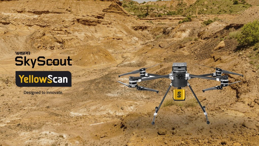
“We are thrilled to partner with WISPR as they bring their brand new SkyScout to market. The combination of the SkyScout and YellowScan LiDAR perfectly addresses the C2 class needs currently underserved in Europe” said Joseph Dannemiller, Managing Director at YellowScan Inc. “Our LiDAR technology, known for its accuracy and reliability, perfectly complements WISPR’s platforms. Together, we are creating a powerful solution that will drive innovation in data collection and aerial mapping throughout the North America and all of Europe.”
The collaboration leverages YellowScan’s precision LiDAR systems, which are recognized for capturing detailed 3D data, with WISPR’s cutting-edge drones known for their durability, flexibility, and autonomous capabilities. This partnership will enable users to access high-resolution data with greater ease, accuracy, and cost-effectiveness than ever before.
CUAV Expo 2024 Unveiling
The official unveiling of the new integrated system will take place at CUAV Expo 2024 in Las Vegas. Attendees are invited to visit YellowScan’s Booth 1131 to discover the system’s capabilities and speak with technical experts from both YellowScan and WISPR. The teams will provide insights into how this integrated solution is designed to transform data capture, mapping, and analysis for commercial applications.
About YellowScan: YellowScan designs, develops, and produces UAV LiDAR solutions for professional applications. Known for their accuracy, robustness, and ease of use, YellowScan’s LiDAR systems are utilized in a range of industries, including forestry, mining, and topographic surveys.
About WISPR Systems : Founded in 2016, WISPR Systems manufactures reliable and affordable U.S.A. commercial Unmanned Aircraft Systems (UAS) with turnkey payload options for commercial operations. WISPR Systems supports various industries with its drones such as surveying, mapping, telecommunications, utilities, public safety and much more.
Media Contact:
WISPR Systems
Christin Yates
Christin.yates@labdigitalcreative.com