Using LiDAR and AI to analyze eucalyptus plantations in Portugal

Challenge
For over three years, MOST Robotics, the YellowScan distributor for the DACH region, has collaborated with Clear Timber, a Dutch forestry inspection company, on various forest mapping projects. During this time, they have utilized a range of LiDAR systems including the YellowScan Mapper version 2, Mapper version 3, Vx20-300, Surveyor Ultra version 2, Surveyor Ultra version 3, and Voyager to capture point clouds of diverse tree species and gather data for AI training and analysis. This extensive experience has allowed them to identify the optimal scanner requirements for efficient workflows.
However, when the company named Navigator, a leading producer of eucalyptus-based paper products in Portugal, sought Clear Timber’s expertise for managing their extensive eucalyptus plantations, they faced new challenges. Navigator’s forests are spread across Portugal, with trees at different stages of growth, and they had been relying on students to manually measure tree trunks, a labor-intensive, inconsistent method. This manual process slowed down their production planning and hindered their ability to monitor the forest effectively.
Clear Timber turned to MOST Robotics to help them scale up their operations, overcome the logistical difficulties of working in rugged terrain, and implement a more efficient, data-driven solution.
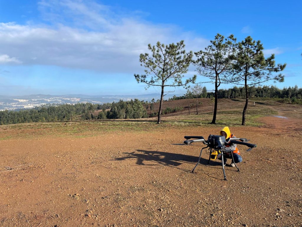
YellowScan Voyager on Acecore Noa
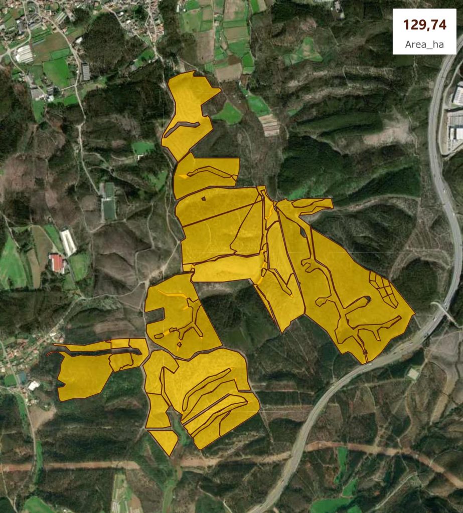
Project area : 129,74 Area_ha
Solution
To meet this challenge, Most Robotics partnered with Clear Timber and deployed the YellowScan Voyager LiDAR system. For this project in Portugal, they selected the Voyager for its ability to capture high-resolution, accurate data over large areas.
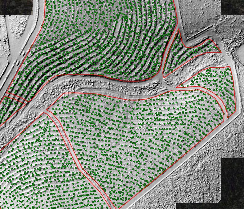
Tree locations
Mission Parameters
- Survey Size: 250 hectares of eucalyptus plantation
- Duration:
- Data acquisition: 13 cross-grid flights, 30 to 40min each
- Data processing: Processing 660 GB of data, creating a detailed point cloud
- Number of flights: 13
- Flight speed and altitude: 60 meters, with 50% overlap
- Equipment: Acecore NOA with YellowScan Voyager LiDAR system
Despite facing rainy weather and difficult terrain on the first day, the team successfully captured 14 billion data points. The comprehensive data provided detailed insights into tree trunk locations, diameters, and crown sizes, allowing the Portuguese company, Navigator, to efficiently monitor and plan for eucalyptus harvesting.
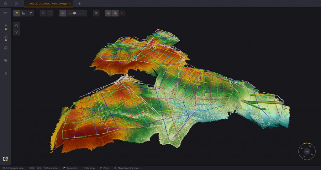
Elevation overview in the YellowScan CloudStation
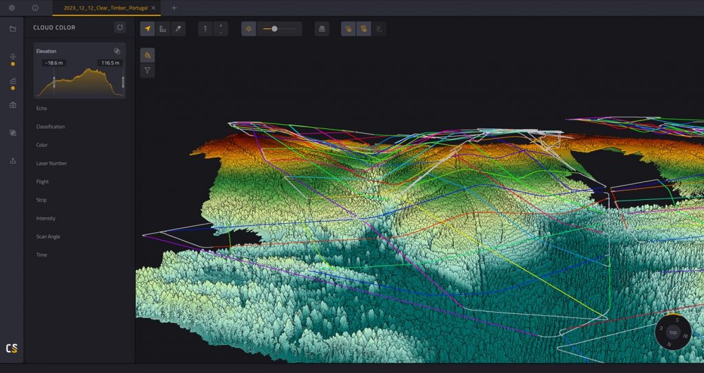
Flight trajectory and elevation from the side
Results
- Accuracy: 2-3 cm accuracy in trunk diameter
The collaboration between Most Robotics and Clear Timber proved to be a major success, transforming the way Navigator manages its eucalyptus plantations. By leveraging LiDAR and AI technology, Navigator can now replace manual tree measurements with highly accurate, automated data collection. This shift has significantly improved efficiency, reducing labor costs while optimizing production planning. The detailed LiDAR data also supports better decision-making for sustainable forest management, allowing Navigator to monitor forest health and growth stages more effectively.
They now can scale their operations, reduce manual labor, and adopt more precise and sustainable forestry practices.
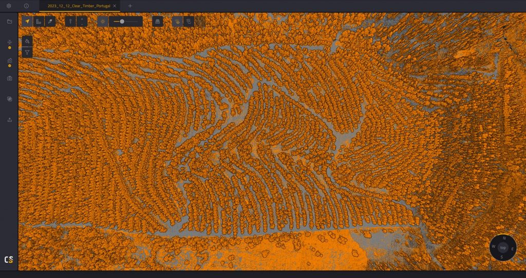
Classification from the top
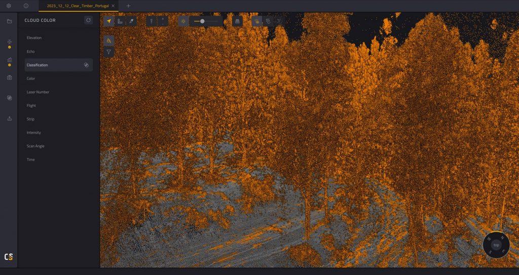
Classification from the side
The YellowScan Voyager is designed to handle complex environments, like dense forests or uneven terrain, with ease. Its ability to deliver high-density point clouds and accurate data in such conditions is what sets it apart.