2D vs 3D LiDAR: A Comparison of Two Laser Scanning Technologies

Introducing 2D LiDAR
This article covers 2D and 3D Lidar. We’ll compare both technologies and explain how they work, the different outputs of each, and their benefits, limitations, and popular use cases.
What is 2D LiDAR and how does it work?
This 2D sensing technology uses light to measure distances from its source to a target. Using the time it takes the light to hit the target and return to the sensor, combined with the speed of light, the distance to the target is measured accurately. The sensor is often mounted on a moving platform, such as a robot. A static platform is also optional.
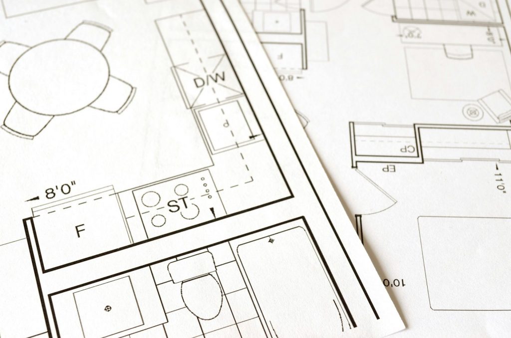
The process of pulse emission, reflection, and object detection is repeated rapidly across a wide area, to sense and detect objects and create a 2D representation of the area and the objects inside of it. An example of this would be a 2D floor plan created by a robot vacuum cleaner of your house, showing the outlines of individual rooms, and the different objects inside of it, but without any height information. Here, obstacles appear as distinct shapes or clusters of points in the map where the laser beam bounces off the objects.

A 2D LiDAR sensor typically uses a rotating mirror or sensor to emit laser pulses across a single, fixed angle to capture objects in its surroundings. This sensor or mirror rotates within a horizontal or vertical plane to scan across that plane. Because 2D LiDAR scans only in a single plane, either data from a flat, horizontal, or vertical cross-section of the area is captured.
A more detailed explanation of how LiDAR works is found in a separate article. More information on the different ways in which LiDAR measures distances is found in another article.
What are the different outputs of 2D LiDAR?
Here is an overview of some of the outputs from 2D LiDAR:
• 2D point clouds: a collection of distance measurements in a two-dimensional plane. An example is a 2D map of an indoor space, such as the floor plan with different rooms, showing different objects and walls.
• 2D maps: LiDAR is one component of SLAM (simultaneous localization and mapping), a technology for positioning an object within its environment and creating a map to orientate and move within it.
• Distance measurements from the sensor to different objects in the environment. The distance and size measurements from 2D LiDAR enable obstacle detection.
Who uses 2D LiDAR?
Robots use 2D LiDAR for navigation, obstacle detection, and environment mapping to move safely in a variety of applications:
• Manufacturing: robots navigate complex assembly lines autonomously, reducing the need for human intervention and streamlining production processes.
• Logistics: robots navigate warehouses and distribution centers to optimize inventory management and order fulfillment.
• Agriculture: robots autonomously navigate crop fields and perform crop monitoring and precision spraying.
• Healthcare: robots can navigate hospital corridors safely for medication delivery, or patient monitoring.

This technology is also used in security applications, including perimeter detection or tracking movement in defined areas. Other 2D LiDAR applications include autonomous vehicles, river surveys, modeling pollution, archeology, and building construction.
What are the benefits of 2D LiDAR?
Here are some of the benefits of 2D LiDAR:
• Accuracy: 2D LiDAR accurately detects obstacles and plans optimal paths.
• Speed/efficiency: 2D LiDAR sensors are highly efficient with quick response times. They use single-line LiDAR, which emits a single-line laser beam by the laser source, resulting in a fast scanning speed, strong resolution, and high reliability.
• Reliability across different environmental conditions: unlike vision-based sensors, LiDAR operates well in a variety of lighting conditions, and even in the dark. This reliability enhances its usability in different scenarios.
• Cost: 2D LiDAR sensors are generally more affordable than 3D LiDAR sensors.
These four factors combined explain why 2D LiDAR is often used for robotics in logistics, where they operate on a flat surface and capturing data in two dimensions is almost always sufficient. Here, relevant obstacles and navigation points exist on the same plan so that there’s no need for vertical plane data.
What are the limitations of 2D LiDAR?
The two main drawbacks of 2D LiDAR are limited depth information and usability under extreme environmental conditions.
• Limited depth information: the main drawback of 2D LiDAR is limited depth information. Depth measurements in 2D LiDAR refer to measuring the distance to an object. Because 2D LiDAR only scans in one plane, it can only measure depth within that plane. This means that objects outside the scanning plane will not be detected by the sensor, which can limit the application of 2D LiDAR. For example, a 2D LiDAR sensor mounted on a robot facing horizontally can measure the distance to objects that lie on the same horizontal plane, but won’t detect objects above or below that plane.
• Limited performance under environmental conditions such as rain or fog. These scatter the laser beams and affect data accuracy. A more detailed discussion about LiDAR and its use in different weather conditions is found in a separate article.
Introducing 3D LiDAR
Now that we have an understanding of what is 2D LiDAR and how it is used in practice, we’ll have a look at 3D LiDAR before comparing it side-by-side with 2D LiDAR.
What is 3D LiDAR and how does it work?
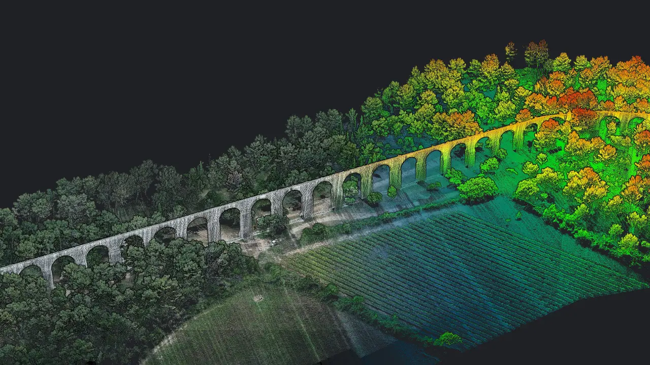
Similar to 2D LiDAR, 3D LiDAR uses lasers to measure distances by timing the reflection of the laser beam off surfaces. Repeating this process millions of times creates a 3D point cloud where all 3D points are stored. Generating millions of data points per second, 3D LiDAR systems offer highly accurate, precise, and detailed mapping data. A 3D laser scanning system directly captures and stores a 3D point cloud which forms the basis for derived 3D products, including maps and models.
3D LiDAR is captured using a static or mobile platform on which the scanner is mounted. The differences between mobile and static LiDAR scanning are explained in a separate article. How 3D LiDAR scanners work is explained in another article. 3D LiDAR data can also be captured from the air, which is a different category of LiDAR scanning altogether. One popular platform for capturing LiDAR today is a drone, which is covered in another article.
What are the benefits for 3D LiDAR?
3D LiDAR has multiple benefits. Here are some of them:
• High accuracy: 3D laser scanning results in accurate 3D measurements, benefitting applications where high precision matters.
• Rapid data capture: large volumes of point data captured per second, for quick turnaround times and lower project costs.
• Versatility: 3D laser scanning can be applied to capture a wide range of objects, textures, and materials.
• Capture once, use often: the captured point cloud data can be used to derive a multitude of maps and models.
3D LiDAR use cases
Applications that require the high accuracy and precision of 3D LiDAR data are the following:
• Surveying and mapping: centimeter-level accuracies are obtained using 3D LiDAR and additional techniques such as PPK, RTK, and ground control points.
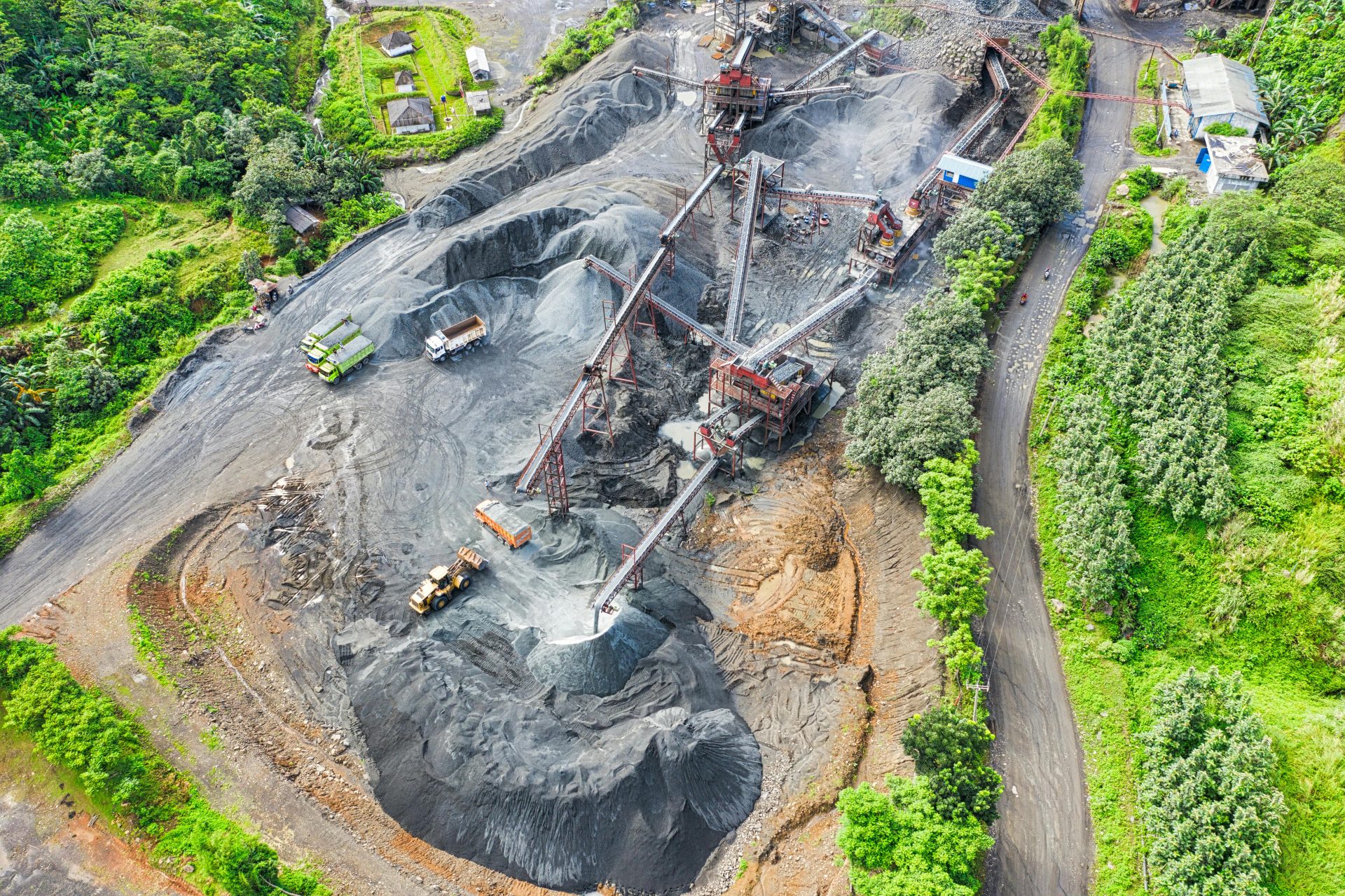
• Mining: precise volumetric calculations of open mine pits are a popular drone LiDAR use case.
• Construction & Engineering: monitoring of construction projects.
• Digital Heritage & Archeology: 3D LiDAR is a safe and non-contact technology, so 3D scanners do not have to touch the scanned object. This makes it an ideal technology for capturing delicate or fragile objects and sites containing such objects, for example from the air using a drone LiDAR system.

How is 3D LiDAR different from 2D LiDAR?
The main difference between the two systems is that the latter captures data in three dimensions, whereas 2D LiDAR only captures data on a single plane. Put differently, 3D employs various lasers at various angles, resulting in larger data volumes, but also more information about the environment as a larger extent of that environment is covered with 3D laser scanning.
This is perhaps better explained using a metric called Field of View (FoV), which expresses the observable area that a laser scanner can capture a 3D scan from a certain distance. The main difference between a 2D and 3D laser scanner is the vertical FoV of a 3D laser scanner, which typically ranges from 30° to 90°, depending on how many layers or planes the sensor can scan. For a 2D laser scanner, the horizontal coverage is typically 180° to 360°, but there’s no vertical scanning: the scanner cannot capture information above or below that plane.
Capturing a larger extent comes at a price, as 3D LiDAR scanners are more expensive that 2D sensors. Besides capturing more and accurate data, they also cover larger ranges than 2D LiDAR sensors: up to 200 meters, compared to 40 meters when using 2D LiDAR. 3D LiDAR sensors often are integrated into a scanning system with more hardware than just a sensor: an IMU and GPS receiver are also required to capture precise positioning data during scanning. This makes 3D laser scanners less portable than 2D, although 3D laser scanners are better in mapping complex environments and recognizing moving and static objects than 2D scanners, as they capture more and accurate data around them.
When choosing a LiDAR system for your mapping needs, YellowScan has get you covered. Consult our product comparison page to see which YellowScan LiDAR scanner meets your needs to make your next project a success.
Frequently Asked Questions
Which industries prefer 2D LiDAR over 3D LiDAR?
Industries that rely on robotic solutions often prefer 2D over 3D LiDAR, including security, manufacturing, and logistics.
What are the benefits of 3D LiDAR?
3D LiDAR captures large volumes of precise and accurate 3D data quickly and safely. The point cloud data can be captured once, and used often for different deliverables.
How does the 2D LiDAR work?
2D LiDAR is a sensing technology that uses light to measure distances from its source to a target. 2D LiDAR captures data from a flat, horizontal or vertical cross-section of an area of interest, to produce 2D point cloud or map.
What does 3D LiDAR mean?
3D LiDAR captures the surrounding area in 3D, through millions of lasers that are emitted in all directions around the scanning device. The resulting range measurements are stored in a 3D point cloud, that shows a 3D representation of an area of interest.
What is the difference between 2D and 3D LiDAR sensors?
2D LiDAR captures less information about the surroundings than 3D LiDAR, as it cannot capture information above or below the horizontal plane. The resulting data is also of lower accuracy and has a lower distance range than a 3D LiDAR sensor.


