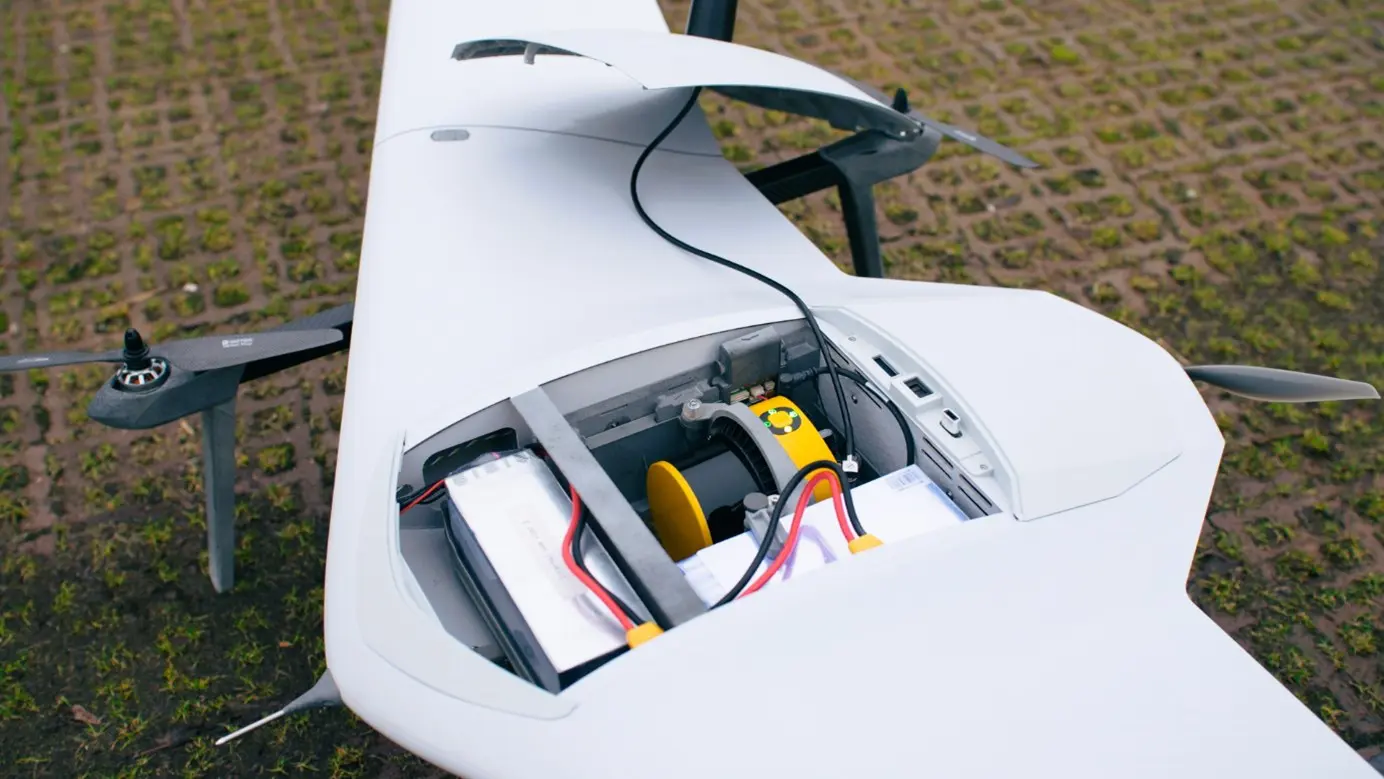
YellowScan Partners again with DeltaQuad to Boost Mapping Productivity with a new LiDAR mapping Integration in the Evo.

Montpellier, France – October 7, 2024 – YellowScan, a global leader in the aerial LiDAR solutions, has joined forces with DeltaQuad, a top Dutch drone manufacturer, to launch the Surveyor Ultra integrated into DeltaQuad’s drone technology. This powerful collaboration is set to significantly enhance productivity in UAV-based LiDAR mapping, offering unmatched efficiency for large-scale mapping projects.
The integration of YellowScan’s Surveyor Ultra with the DeltaQuad Evo platform brings new levels of productivity, allowing users to gather high-precision, high-density data faster and more efficiently than ever before with 1200ha covered in 1 single flight. Thanks to an embedded RGB camera, operators can collect LiDAR & RGB simultaneously to cover larger areas in less time, hence reducing project timelines and costs without compromising quality.
Julien BO, Senior Business Development Europe at YellowScan, highlighted the value of this integration: “The combination of the YellowScan Surveyor Ultra and DeltaQuad’s advanced Evo drone platform is designed to maximize productivity in the field. Users can now achieve faster, more detailed results, whether they are working on large infrastructure projects, forestry analysis, or environmental monitoring. Our users can now deliver georeferenced LiDAR pointcloud, colorize them with RGB data, generate Digital Terrain Models in a few clicks and if needed generate orthophoto as well from a 2h30 long flight from the Evo: a must for productivity.”
The DeltaQuad Evo long-range flight capabilities and efficient VTOL design make it ideal for mapping expansive areas. When paired with the Surveyor Ultra’s cutting-edge LiDAR technology, which delivers dense point clouds even at higher altitudes, users can dramatically streamline their workflows, reducing time spent in the air and on post-processing tasks.
DeltaQuad Solution Specialist Benji Pauly noted the partnership’s impact on increasing user productivity: “Integrating YellowScan’s Surveyor Ultra with our DeltaQuad Evo platform is a step forward in aerial surveying efficiency. By combining long-range flight capabilities with high-precision LiDAR, we’ve created a solution that helps professionals do more in less time. This partnership is all about empowering users to work smarter, not harder.”
As demand for fast, reliable, and precise geospatial data continues to rise, the YellowScan and DeltaQuad partnership offers a solution that enhances both operational efficiency and project turnaround time. This breakthrough is set to benefit a wide range of industries, including surveying, construction, forestry, and environmental research.
About YellowScan
YellowScan is renowned for its high-performance aerial LiDAR solutions, offering fully integrated, turnkey systems that streamline the data collection process. Professionals across the globe use YellowScan’s solutions to enhance productivity in industries such as surveying, forestry, and infrastructure development.
About DeltaQuad
DeltaQuad is a leader in long-range VTOL UAV technology, providing advanced drone solutions for mapping and surveillance. Their drones are designed to deliver superior range, reliability, and ease of use, enabling users to maximize productivity in various professional applications.
For more information, visit www.yellowscan.com and www.deltaquad.com.
Media Contact:
Morgane Selve – Head of Marketing and Communications @yellowscan
press@yellowscan.com


