Using LiDAR for Emergency Response in Alaska

Challenge
Frontier Precision faced a critical challenge when their long-term client, the Alaska Department of Transportation (DOT), needed to rapidly and accurately map the area affected by the Mendenhall Glacier flood in Juneau, Alaska.
This flood, triggered by unseasonably warm temperatures and heavy rain, caused significant runoff from the glacier, threatening the town and resulting in property damage. The DOT required detailed aerial surveys to assess the flood’s impact and plan their response. However, the congested airspace, combined with the need for swift data collection, made this a complex task, especially given the area’s popularity as a tourist destination, which added further airspace constraints.
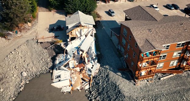
Destroyed houses and property damages because of the flood
Solution
To meet the Alaska DOT’s urgent need for accurate and timely mapping, Frontier Precision deployed drone and LiDAR technology. The equipment used included the YellowScan Voyager LiDAR system and a Quantum Systems Trinity Pro drone. These were chosen for their ability to cover large areas quickly and operate safely in the congested airspace around Juneau.
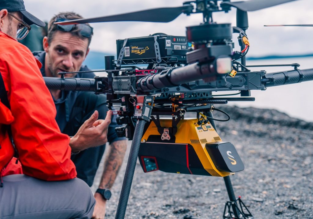
YellowScan Voyager mounted on the Alta X
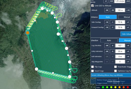
Flight plan of the acquisition
Mission Parameters
- Survey Size: 1,200 hectares (3,000 acres)
- Duration: Approx. 6 hours for data acquisition
- Number of Flights: Two main flights
- Flight Speed: 35 km/h (22 miles per hour)
- Altitude: 244 meters AGL (800 feet AGL)
- Equipment:
- Drones Used: Quantum Systems Trinity Pro and Alta X (for Voyager)
- LiDAR System: YellowScan Voyager
- Data Processing Software: YellowScan CloudStation
Preparing for the mission launch © Scandinavian Drone
Results
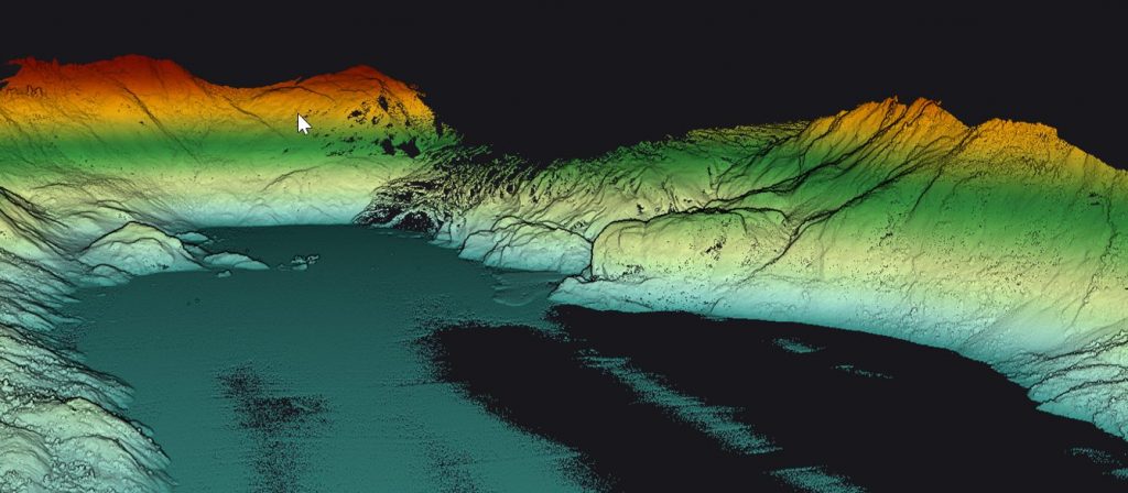
- High Density Pointcloud: 160 pts/sqM
The operation was a resounding success, significantly reducing the expected data collection time from four to five days to just six hours. This rapid data acquisition minimized disruptions to air traffic and tourism, allowing the DOT to continue their disaster response with minimal interference. The detailed LiDAR data provided high-resolution elevation models that were crucial for assessing flood impacts and planning further action. The ability to model potential flood scenarios and predict future risks was a key outcome, directly influencing the DOT’s decision-making process.
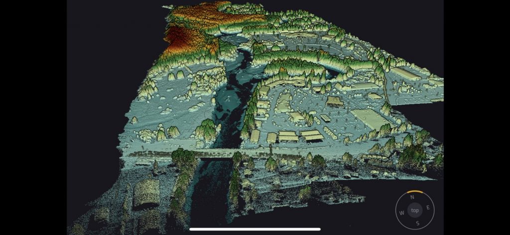
Pointcloud of the city of Juneau
After seeing how effective the YellowScan Voyager was during this project, the Alaska Department of Transportation decided to procure one of their own. This is a big win for us and shows that high-level agencies like DOTs and other government bodies are recognizing the value of this equipment for their critical projects. The Voyager’s ability to rapidly and accurately collect data has made a significant impact on their operations.

Nathan Stephenson
Applied Geospatial Engineer – Frontier Precision
